1
Tooting Junction Baptist Church
On Longley Road, dated 1936: http://www.tjbc.org.uk/
Image: © Mike Faherty
Taken: 23 Nov 2013
0.02 miles
2
Tooting Baptist Church
On Longley Road.
Image: © David Anstiss
Taken: 9 Dec 2012
0.03 miles
3
Path and railway track, Tooting
Taken from a footbridge across the railway line about 200 metres west of Tooting Station. Behind the car park are buildings on London Road, the A217. The footpath joins Longley Road. The three-storey block of flats replaced an old railway building on the site.
Image: © Derek Harper
Taken: 30 Nov 2009
0.04 miles
4
Tooting, gospel hall
Longley Road Gospel Hall, dated 1884.
Image: © Mike Faherty
Taken: 23 Nov 2013
0.05 miles
5
Gospel Hall, Tooting
Small church along Longley Road, between rows of terraced housing.
Image: © David Anstiss
Taken: 9 Dec 2012
0.05 miles
6
Bickersteth Road, SW17
View north, with the corner of Renmuir Street a short distance ahead, on the right.
Image: © Stefan Czapski
Taken: 3 Jun 2015
0.05 miles
7
Tooting Junction railway station (site), Greater London
Opened in 1868 jointly by the London Brighton & South Coast Railway and the London & South Western Railway, on the line from Streatham to Wimbledon, this station closed to passengers in 1894 when it was replaced by a new station immediately behind the camera position.
View west towards Haydons Road and Wimbledon, the former branch-line platform to Merton Abbey turned southwards where the supermarket now is. 120 years after the Wimbledon line platforms last saw passengers, they are still there!
Image: © Nigel Thompson
Taken: 13 Nov 2014
0.06 miles
8
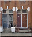
Front doorways, Glasford Street
The doors on the left are almost certainly the Victorian originals - and rather handsome.
Image: © Stefan Czapski
Taken: 3 Jun 2015
0.07 miles
9
Glasford Street, SW17
View eastwards from the Bickersteth Road end.
Image: © Stefan Czapski
Taken: 3 Jun 2015
0.08 miles
10
Digging up Bickersteth Road
It looks like something to do with water.
Image: © Robin Webster
Taken: 6 May 2012
0.08 miles


