
IMAGES TAKEN NEAR TO
Nimrod Road, LONDON, SW16 6TJ
Introduction
This page details the photographs taken nearby to Nimrod Road, SW16 6TJ by members of the Geograph project.
The Geograph project started in 2005 with the aim of publishing, organising and preserving representative images for every square kilometre of Great Britain, Ireland and the Isle of Man.

There are currently over 7.5m images from over14,400 individuals and you can help contribute to the project by visiting https://www.geograph.org.uk
Image Map
Images are licensed for reuse under creativecommons.org/licenses/by-sa/2.0
Notes
- Clicking on the map will re-center to the selected point.
- The higher the marker number, the further away the image location is from the centre of the postcode.
Image Listing (56 Images Found)
Images are licensed for reuse under creativecommons.org/licenses/by-sa/2.0
Image
Details
Distance
1
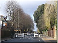
Road blockage on Welham Road
This road leads from Mitcham Lane to Rectory Lane.
It passes two schools on either side, so hence the road is calmed for the schoolchildren.
Image: © David Anstiss
Taken: 9 Dec 2012
0.05 miles
2
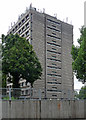
London Institute, Spalding Road
Brutalism comes to Tooting. Aggressively concrete tower built as student accommodation in 1961-65 by L. Manasseh and Partners for Furzedown Teacher Training College.
It currently serves as halls of residence for the University of the Arts London.
Image: © Stephen Richards
Taken: 13 Aug 2011
0.05 miles
3
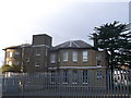
Furzedown House
A Grade II listed former house on Spalding Road.
Now used as Graveney Secondary school.
See http://www.britishlistedbuildings.co.uk/en-207217-furzedown-house-and-attached-conservator for more details about the house.
Image: © David Anstiss
Taken: 9 Dec 2012
0.07 miles
4
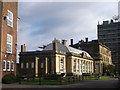
Furzedown House, Graveney School
A Grade II listed former house on Spalding Road.
Now part of Graveney Secondary school, a secondary school with specialist Technology College status.
See http://www.britishlistedbuildings.co.uk/en-207217-furzedown-house-and-attached-conservator for more details about the listed house.
The school has various buildings on the large campus.
In the background is Image
Image: © David Anstiss
Taken: 9 Dec 2012
0.09 miles
5
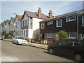
Houses lost to bombing in Pendle Road
Most of the houses in Pendle Road are pre First World War, but nearest the camera they were destroyed in the Second World War and have been replaced by modern houses.
Image: © Marathon
Taken: 1 Sep 2010
0.10 miles
6
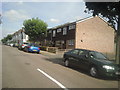
Pendle Road
Most of the houses in Pendle Road are pre First World War, but nearest the camera they were destroyed in the Second World War and have been replaced by modern houses.
Image: © Marathon
Taken: 1 Sep 2010
0.12 miles
7
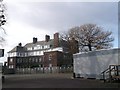
Graveney School, Furzedown
Graveney School is a secondary school with specialist Technology College status.
The school has various buildings on the large campus on Spalding Road.
Image: © David Anstiss
Taken: 9 Dec 2012
0.13 miles
8
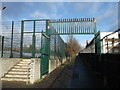
Footpath to Ramsdale Road
This path leads from Welham Road, through Graveney School.
The sports field (with astro-turf is on the left).
Image: © David Anstiss
Taken: 9 Dec 2012
0.13 miles
9
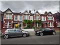
Petoria Road
Victorian terrace housing.
Image: © James Emmans
Taken: 13 May 2020
0.13 miles
10
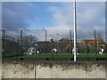
Astro-turf Sports field, Furzedown
Part of Graveney School, sports field.
Image: © David Anstiss
Taken: 9 Dec 2012
0.15 miles