1
Flats, Streatham High Road (A23)
Unusually a substantial wall in front of them, probably added later.
Image: © Robin Webster
Taken: 19 Apr 2019
0.09 miles
2
A23, Streatham High Road, SW16
By the Hermitage Lane bus stop, towards Streatham Hill.
Image: © Robin Webster
Taken: 19 Apr 2019
0.10 miles
3
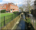
The River Graveney
A tributary of the River Wandle, this stream has just undergone a name change.
Upstream of the culvert seen mid shot here, it's called the Norbury Brook.
A classic urban river in a dismal concrete trench, it has fared better than some others in that it is still above ground.
http://en.wikipedia.org/wiki/Norbury_Brook
Image: © Des Blenkinsopp
Taken: 31 Mar 2015
0.10 miles
4
Streatham High Road at the junction with Green Lane
Image: © David Howard
Taken: 7 Oct 2012
0.10 miles
5
Car wash on Streatham High Road
Looking across to Green Lane
Image: © David Howard
Taken: 29 Sep 2013
0.11 miles
6
Lidl's Norbury Branch
On Streatham High Road.
Image: © Des Blenkinsopp
Taken: 31 Mar 2015
0.11 miles
7
Junction of B273, Green Lane, with A23, Streatham High Road
Image: © Robin Webster
Taken: 19 Apr 2019
0.11 miles
8
A23, Streatham High Road, SW16
At the Green Lane traffic lights, heading north.
Image: © Robin Webster
Taken: 19 Apr 2019
0.11 miles
9
Former church hall, Guildersfield Road
Designed by Ernest George and Alfred Yeates, 1898. George lived locally and his firm built a lot in the area. They used a lot of Dutch motifs, witness the prominent gable here. Grade II listed.
The hall is adjacent to the former vicarage to St Andrew's Church (also by George) which stood to the south-west of the vicarage until it was gutted by fire in 1992 and subsequently demolished (replaced by new housing). The former church hall now houses a GPs' practce.
Image: © Stephen Richards
Taken: 8 Aug 2009
0.11 miles
10
Hand car wash on Streatham High Road
Looking towards Green Lane
Image: © David Howard
Taken: 7 Oct 2012
0.11 miles


