IMAGES TAKEN NEAR TO
Norbury Crescent, LONDON, SW16 4JX
Introduction
This page details the photographs taken nearby to Norbury Crescent, SW16 4JX by members of the Geograph project.
The Geograph project started in 2005 with the aim of publishing, organising and preserving representative images for every square kilometre of Great Britain, Ireland and the Isle of Man.

There are currently over 7.5m images from over14,400 individuals and you can help contribute to the project by visiting https://www.geograph.org.uk
Image Map
Images are licensed for reuse under creativecommons.org/licenses/by-sa/2.0
Notes
- Clicking on the map will re-center to the selected point.
- The higher the marker number, the further away the image location is from the centre of the postcode.
Image Listing (28 Images Found)
Images are licensed for reuse under creativecommons.org/licenses/by-sa/2.0
Image
Details
Distance
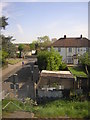
2
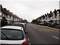
Norbury Crescent
This long straight road leads from the A23 London Road, then after a junction with Strathyre Avenue, it becomes Melfort Road towards Thornton Heath.
See Image
Image: © David Anstiss
Taken: 30 Oct 2011
0.06 miles
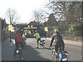
3
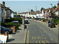
Norbury Crescent, Norbury
By the Dunbar Avenue bus stop towards Streatham.
Image: © Robin Webster
Taken: 19 Apr 2019
0.06 miles
4
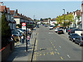
Norbury Crescent, Norbury
By the Ederline Avenue bus stop towards Streatham.
Image: © Robin Webster
Taken: 19 Apr 2019
0.10 miles
5
Railway Bridge over Manor Farm Road
This road leads from Norbury Avenue to Norbury Crescent.
Image: © David Anstiss
Taken: 30 Oct 2011
0.12 miles
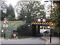
7
Low Bridge on Manor Farm Road
Despite the prominent warning signs, this railway bridge with a height of only 2.6m has a history of being struck by vehicles.
Image: © Stephen Craven
Taken: 16 Feb 2008
0.14 miles
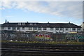
8
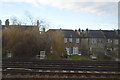
Manor Farm Road, Norbury, from the train
The suburbia round here, be it inter-war semis or Victorian terraces, dates from after the coming of the railway and accordingly the street pattern works around the railway lines: this is one of the few crossings of the line between Norbury and Thornton Heath stations.
Image: © Christopher Hilton
Taken: 19 Apr 2011
0.15 miles
9
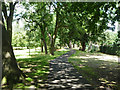
Shady path, Norbury Hall Park
A public park, formerly the grounds of a house.
Image: © Robin Webster
Taken: 1 Jul 2011
0.15 miles
10
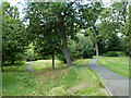
Norbury Hall park
Formerly the grounds of a house, with a lake. the small path branching left is dropping down into the lake area, which is now drained.
Image: © Robin Webster
Taken: 1 Jul 2011
0.15 miles