IMAGES TAKEN NEAR TO
Benhurst Lane, LONDON, SW16 2JB
Introduction
This page details the photographs taken nearby to Benhurst Lane, SW16 2JB by members of the Geograph project.
The Geograph project started in 2005 with the aim of publishing, organising and preserving representative images for every square kilometre of Great Britain, Ireland and the Isle of Man.

There are currently over 7.5m images from over14,400 individuals and you can help contribute to the project by visiting https://www.geograph.org.uk
Image Map
Images are licensed for reuse under creativecommons.org/licenses/by-sa/2.0
Notes
- Clicking on the map will re-center to the selected point.
- The higher the marker number, the further away the image location is from the centre of the postcode.
Image Listing (94 Images Found)
Images are licensed for reuse under creativecommons.org/licenses/by-sa/2.0
Image
Details
Distance
2
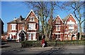
286 and 288 Leigham Court Road
Two of a group of five large Victorian houses at the south end of the road. The one on the right has an elaborate castellated porch and a large staircase window. They are within the Leigham Court Road (South) Conservation Area.
Leigham Court Road was laid out in 1839, and while development began in the early 1840s, it didn’t really take off until after the building of the Crystal Palace and West End Railway and the opening of Streatham Hill station in 1856. Quite a number of the original, large Victorian houses survive at either end of the road, and even though their grounds have in some cases since been built on, the remaining mature trees and general landscaping have enabled the area to retain “much of its original arcadian character.” Information from Lambeth Council (http://www.lambeth.gov.uk/NR/exeres/CE4B5CE1-0387-40ED-B5A9-273A5160C34A.htm )
Image: © Stephen Richards
Taken: Unknown
0.03 miles
3
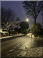
Snowy Leigham Court Road
An inch or two of snow had been deposited in the morning, the first in this area for a couple of years if memory serves. It had mostly gone by the evening, but some persisted into the following day as temperatures dropped but everything had gone green by the day after that.
Image: © Stephen Richards
Taken: 24 Jan 2021
0.04 miles
5
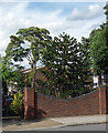
Monkey puzzle, Valleyfield Road
Its proper scientific name is Araucaria araucana.
Image: © Stephen Richards
Taken: 30 Jul 2012
0.04 miles
6
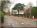
Leigham Court Road
The stretch of road between the junction with Ilex Way and Leaf Grove.
Image: © Derek Harper
Taken: 13 Jan 2011
0.04 miles
7
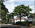
Cedar Tree on Leigham Court Road
Rather fine deodar (Cedrus deodara), I believe.
This was my initial speculation, since endorsed by a correspondent, so I am reasonably confident.
Image: © Stephen Richards
Taken: 30 Jul 2012
0.05 miles
9
Leigham Court Road (2)
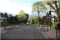
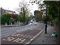
Looking south, opposite St Julian's Close. This is pretty much the reverse of this view: Image The road is named after Leigham Court, a large house which was demolished in 1908. This stretch of the road is within the Leigham Court Road (South) Conservation Area due to its remaining mature trees and general landscaping which mean it has retained “much of its original arcadian character.” Information from Lambeth Council (http://www.lambeth.gov.uk/NR/exeres/CE4B5CE1-0387-40ED-B5A9-273A5160C34A.htm )
Image: © Stephen Richards
Taken: Unknown
0.06 miles