IMAGES TAKEN NEAR TO
Ullswater Close, LONDON, SW15 3RF
Introduction
This page details the photographs taken nearby to Ullswater Close, SW15 3RF by members of the Geograph project.
The Geograph project started in 2005 with the aim of publishing, organising and preserving representative images for every square kilometre of Great Britain, Ireland and the Isle of Man.

There are currently over 7.5m images from over14,400 individuals and you can help contribute to the project by visiting https://www.geograph.org.uk
Image Map
Images are licensed for reuse under creativecommons.org/licenses/by-sa/2.0
Notes
- Clicking on the map will re-center to the selected point.
- The higher the marker number, the further away the image location is from the centre of the postcode.
Image Listing (39 Images Found)
Images are licensed for reuse under creativecommons.org/licenses/by-sa/2.0
Image
Details
Distance
5
Kingston University: Kingston Hill Campus
Image: © Dr Neil Clifton
Taken: 29 Jun 2013
0.10 miles
6
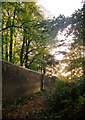
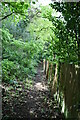
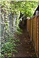
By the Park wall, Broomfield Hill
The trees on this part of Broomfield Hill are mostly beech and hornbeam. At this point along the Park boundary, the beeches on the far side of the wall - in private grounds - appear as tall as any inside the Park.
When the Park was first enclosed - in the reign of Charles I - a continuous passageway (the freebord) was left just outside the wall. Along this stretch of the boundary the freebord has disappeared - and I assume it was absorbed into various plots outside the park. Elsewhere it still exists, the most extensive stretch being between Roehampton and Sheen Gates: http://www.geograph.org.uk/photo/2257983 http://www.geograph.org.uk/photo/2188403
Richmond Park is a National Nature Reserve.
Image: © Stefan Czapski
Taken: 31 Oct 2014
0.11 miles
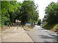
8
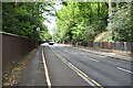
Access roads, Kingston University
Leading from Kingston Hill into the large campus.
Kingston Hill mainly caters to Nursing, Law, Education, Business, Music, Health and Social Sciences.
A lot of large pine trees surround the campus.
Image: © David Anstiss
Taken: 13 Jan 2013
0.11 miles
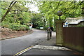
9
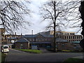
Law school, Kingston University
Part of the Kingston Campus on Kingston Hill.
The music department is situated in Coombehurst House (within the campus). Florence Nightingale was a frequent visitor to the house and indeed the new Learning Resource Centre (seen in the background) was named the Nightingale Centre after her.
The buildings on the left are Student services buildings (including a shop and union).
Image: © David Anstiss
Taken: 13 Jan 2013
0.12 miles
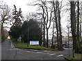
10
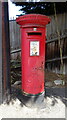
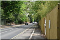
George V postbox on Kingston Vale
Postbox No. SW15 40.
See Image] for context.
Image: © JThomas
Taken: 27 May 2022
0.12 miles