IMAGES TAKEN NEAR TO
Rectory Road, LONDON, SW13 0DX
Introduction
This page details the photographs taken nearby to Rectory Road, SW13 0DX by members of the Geograph project.
The Geograph project started in 2005 with the aim of publishing, organising and preserving representative images for every square kilometre of Great Britain, Ireland and the Isle of Man.

There are currently over 7.5m images from over14,400 individuals and you can help contribute to the project by visiting https://www.geograph.org.uk
Image Map
Images are licensed for reuse under creativecommons.org/licenses/by-sa/2.0
Notes
- Clicking on the map will re-center to the selected point.
- The higher the marker number, the further away the image location is from the centre of the postcode.
Image Listing (103 Images Found)
Images are licensed for reuse under creativecommons.org/licenses/by-sa/2.0
Image
Details
Distance
1
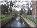
Beverley Brook, Barnes
As seen from Rocks Lane.
Looking upstream.
This stream rises at Cuddington Recreation Park in Worcester Park, before flowing through Motspur Park, New Malden, Wimbledon Common, Richmond Park, and then Putney to head towards the River Thames.
Image: © David Anstiss
Taken: 14 Apr 2013
0.11 miles
2
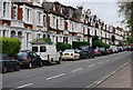
Housing on Rocks Road, Barnes
Typical early 20th century housing in a SW London suburb.
Image: © N Chadwick
Taken: 4 May 2008
0.11 miles
3
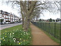
Path beside Rocks Lane
Rocks Lane leads Upper Richmond Road towards Barnes.
This path leads beside Barnes Elms Playing Fields (on the right).
Image: © David Anstiss
Taken: 14 Apr 2013
0.11 miles
4
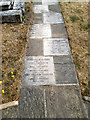
Inscribed names on a church path
This pathway in the churchyard of St Mary, Barnes Image is inscribed with the names of those whose remains are buried in the churchyard.
Image: © Stephen Craven
Taken: 26 Jul 2013
0.13 miles
5
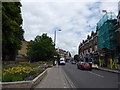
Looking east-northeast in Church Street
Image: © Basher Eyre
Taken: 31 May 2017
0.13 miles
8
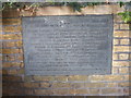
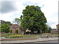
Boer War memorial at St Mary's Church, Barnes
St Mary's Church, Barnes was built in the early 12th century. It was enlarged and re-consecrated in 1215 after the signing of Magna Carta. It was extended to the west in the 13th century, and later to the east, creating a chancel. A west tower was added in the late 15th century. The north wall was demolished in the late 18th century to create a north aisle. A major fire on 8 June 1978 destroyed parts of the church, but left the tower and Norman chapel almost intact.
Memorials to the Boer War are not common. This one is just inside the lych gate. See also https://www.geograph.org.uk/photo/2915299 and https://www.geograph.org.uk/photo/4276426
Image: © Marathon
Taken: 16 Oct 2019
0.13 miles
9
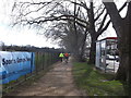
Cyclepath beside Rocks Lane
Rocks Lane leads from Barnes towards Upper Richmond Road.
This path leads beside Barnes Elms Playing Fields (on the left).
It is part of National Cycle Network 4 leading towards Richmond Park.
It also follows the Thames Valley Cycle Route to Reading.
Image: © David Anstiss
Taken: 14 Apr 2013
0.13 miles