IMAGES TAKEN NEAR TO
Old School Close, STOKE-ON-TRENT, ST7 4EZ
Introduction
This page details the photographs taken nearby to Old School Close, ST7 4EZ by members of the Geograph project.
The Geograph project started in 2005 with the aim of publishing, organising and preserving representative images for every square kilometre of Great Britain, Ireland and the Isle of Man.

There are currently over 7.5m images from over14,400 individuals and you can help contribute to the project by visiting https://www.geograph.org.uk
Image Map
Images are licensed for reuse under creativecommons.org/licenses/by-sa/2.0
Notes
- Clicking on the map will re-center to the selected point.
- The higher the marker number, the further away the image location is from the centre of the postcode.
Image Listing (68 Images Found)
Images are licensed for reuse under creativecommons.org/licenses/by-sa/2.0
Image
Details
Distance
1
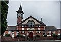
Kidsgrove Town Hall, Victoria Hall
Built 1897..
https://en.wikipedia.org/wiki/Kidsgrove
Image: © Brian Deegan
Taken: 15 Oct 2017
0.06 miles
3
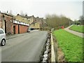
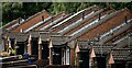
Market Street railway station (site), Staffordshire
Opened in 1909 by the North Staffordshire Railway on its 'Potteries loop line' from Stoke-on-Trent to Congleton via Burslem, this Halt in Kidsgrove closed in 1950.
View east towards Newchapel & Goldenhill and Burslem. The timber-built Halt was in the trees. No trace remains.
Image: © Nigel Thompson
Taken: 7 Feb 2015
0.07 miles
5
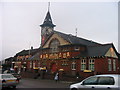
Victoria Hall, Kidsgrove, Staffordshire
Victoria Hall which was formerly the town hall of Kidsgrove in North Staffordshire decorated for Christmas 2005.
Image: © Phil Eptlett
Taken: 20 Dec 2005
0.08 miles
6
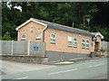
New Police Enquiry Station
Opened in 2008 to facilitate public access to Staffordshire Police local station.
Image: © Barry Boxer
Taken: 16 Aug 2009
0.10 miles
7
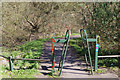
Access to the Potteries Loop
This chicane gives walkers and cyclist access to the route of the Potteries Loop railway - long since closed and now a footpath and cycleway. It is also known as the Scotia Valley Greenway but there is no indication of that here. It is,however, part of Sustrans route 5 which is shown.
Image: © Stephen McKay
Taken: 24 Mar 2017
0.10 miles
8
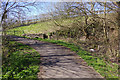
Potteries Loop Line at Mount Road, Kidsgrove
This is part of the long-closed Potteries Loop railway that ran from Etruria to Kidsgrove via Hanley and Tunstall. It is now a path and cycleway but there is no way under Mount Road.
Image: © Stephen McKay
Taken: 24 Mar 2017
0.10 miles