IMAGES TAKEN NEAR TO
Scot Hay Road, NEWCASTLE, ST5 6RQ
Introduction
This page details the photographs taken nearby to Scot Hay Road, ST5 6RQ by members of the Geograph project.
The Geograph project started in 2005 with the aim of publishing, organising and preserving representative images for every square kilometre of Great Britain, Ireland and the Isle of Man.

There are currently over 7.5m images from over14,400 individuals and you can help contribute to the project by visiting https://www.geograph.org.uk
Image Map
Images are licensed for reuse under creativecommons.org/licenses/by-sa/2.0
Notes
- Clicking on the map will re-center to the selected point.
- The higher the marker number, the further away the image location is from the centre of the postcode.
Image Listing (52 Images Found)
Images are licensed for reuse under creativecommons.org/licenses/by-sa/2.0
Image
Details
Distance
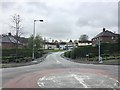
1
Noah's Wood, Silverdale Country Park
The designation 'Noah's Wood' appears to be of recent origin, but this is obviously by far the oldest piece of woodland in the Country Park, the rest of which was a coal mine.
Image: © Jonathan Hutchins
Taken: 30 Apr 2021
0.03 miles
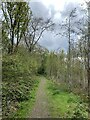
2
Silverdale Country Park: path through Noah's Wood
Image: © Jonathan Hutchins
Taken: 6 Nov 2016
0.04 miles
3
Silverdale Country Park: entrance off Scot Hay Road
Image: © Jonathan Hutchins
Taken: 6 Nov 2016
0.04 miles
4
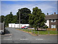
Thirsk Place, Park Site
A short cul de sac off Buxton Avenue, providing access to a set of garages as well as houses.
Image: © Richard Vince
Taken: 29 Jun 2013
0.04 miles
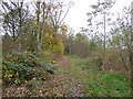
5
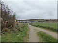
Silverdale Country Park: path by football pitch
The information board by the path in the centre of the pitch can be seen in http://www.geograph.org.uk/photo/5186742
Image: © Jonathan Hutchins
Taken: 6 Nov 2016
0.05 miles
6
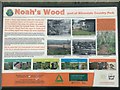
Silverdale Country Park: information board for Noah's Wood
This board and its stand and plinth can be seen alongside the path in the middle of Image]
Image: © Jonathan Hutchins
Taken: 6 Nov 2016
0.05 miles
7
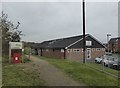
Silverdale: Kents Lane Community Building
'The home of Silverdale Athletic FC founded 1980'.
On the left is a path and signboard for Silverdale Country Park.
Image: © Jonathan Hutchins
Taken: 6 Nov 2016
0.05 miles
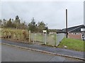
8
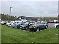
Silverdale: car park for Kents Lane Community Building
Image: © Jonathan Hutchins
Taken: 6 Nov 2016
0.06 miles
9
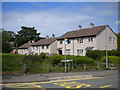
Matlock Place, Park Site
The small green space, off Buxton Avenue, is a pleasant alternative to a short cul de sac.
Image: © Richard Vince
Taken: 29 Jun 2013
0.07 miles