
IMAGES TAKEN NEAR TO
Sandon Road, STOKE-ON-TRENT, ST3 7DL
Introduction
This page details the photographs taken nearby to Sandon Road, ST3 7DL by members of the Geograph project.
The Geograph project started in 2005 with the aim of publishing, organising and preserving representative images for every square kilometre of Great Britain, Ireland and the Isle of Man.

There are currently over 7.5m images from over14,400 individuals and you can help contribute to the project by visiting https://www.geograph.org.uk
Image Map
Images are licensed for reuse under creativecommons.org/licenses/by-sa/2.0
Notes
- Clicking on the map will re-center to the selected point.
- The higher the marker number, the further away the image location is from the centre of the postcode.
Image Listing (27 Images Found)
Images are licensed for reuse under creativecommons.org/licenses/by-sa/2.0
Image
Details
Distance
2
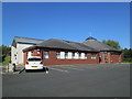
Broadway Methodist Church
The church was opened in 2008.
Image: © David Weston
Taken: 3 May 2017
0.09 miles
3
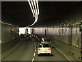
Meir Tunnel, Stoke-on-Trent
Meir Tunnel, which is 284 metres long, forms part of the upgrading of the A50, through a heavily trafficked urban area of Stoke-on-Trent. The tunnel is self-ventilating and varying levels of lighting are provided. Three crossover openings are provided in the central wall (the illuminated "green man" signs can be seen to the right hand side of the carriageway).
Image: © David Dixon
Taken: 8 Aug 2014
0.09 miles
4
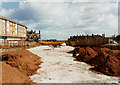
Meir Tunnel (under construction)
Taken during the construction of the tunnel which takes the A50 trunk road under the centre of Meir. In the distance centre-left of the photo is the now-demolished Kings Arms public house. A new Meir Health Centre has been built on that site and opened at the end of 2011.
Image: © Chris Beaver
Taken: Unknown
0.09 miles
5
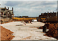
Roof of Meir Tunnel (under construction)
Probably taken during the summer of 1997, this photo shows the bare roof of the A50 road tunnel which now takes traffic under the centre of Meir. To the left is the now-demolished Kings Arms public house. It has since been replaced with the new Meir Health Centre which opened in December 2011.
Image: © Chris Beaver
Taken: Unknown
0.09 miles
6
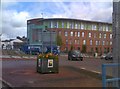
Meir Island
The view of Meir Primary Care Centre from across the roundabout at Meir on the A520.
Image: © Gordon Griffiths
Taken: 12 Sep 2018
0.09 miles
7
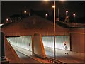
FlyUnder
The Meir Underpass, on the A50 at Stoke. Constructed in 1998, it eased considerably the congestion at this notorious bottleneck.
Image: © Roger May
Taken: 6 Aug 2005
0.11 miles
8
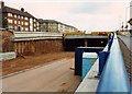
West end of Meir tunnel A50 (during construction)
Probably taken during summer 1997. Fifteen years later (December 2012) they have just replaced the original sodium lighting inside the tunnels with ultra-modern and efficient LED units which must be far cheaper to run and therefore are much more environmentally friendly. Such is progress.
Image: © Chris Beaver
Taken: Unknown
0.11 miles
9
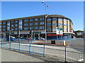
By the roundabout in Meir
The western approach to the roundabout, and the shops beyond.
Image: © David Weston
Taken: 3 May 2017
0.11 miles
10
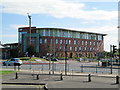
Meir Primary Care Centre
Seen from across the roundabout at Meir.
Image: © David Weston
Taken: 3 May 2017
0.11 miles