Meir Tunnel (under construction)
Introduction
The photograph on this page of Meir Tunnel (under construction) by Chris Beaver as part of the Geograph project.
The Geograph project started in 2005 with the aim of publishing, organising and preserving representative images for every square kilometre of Great Britain, Ireland and the Isle of Man.

There are currently over 7.5m images from over 14,400 individuals and you can help contribute to the project by visiting https://www.geograph.org.uk
Meir Tunnel (under construction)
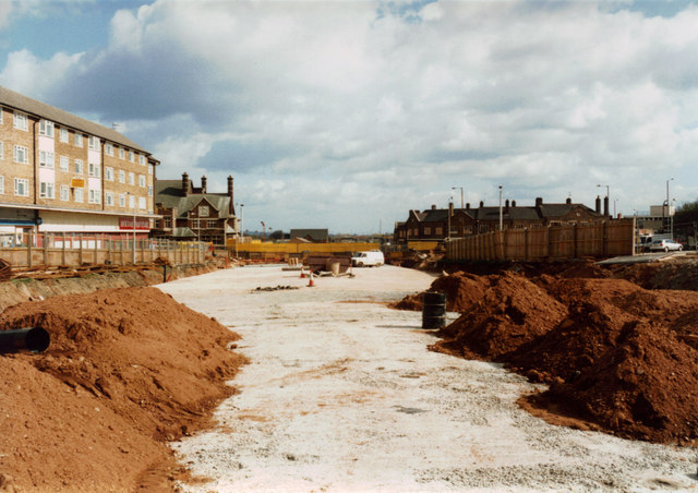
Image: © Chris Beaver Taken: Unknown
Taken during the construction of the tunnel which takes the A50 trunk road under the centre of Meir. In the distance centre-left of the photo is the now-demolished Kings Arms public house. A new Meir Health Centre has been built on that site and opened at the end of 2011.
Images are licensed for reuse under creativecommons.org/licenses/by-sa/2.0
Image Location
Latitude
52.977732
Longitude
-2.104059