
IMAGES TAKEN NEAR TO
Repton Close, STAFFORD, ST17 4TG
Introduction
This page details the photographs taken nearby to Repton Close, ST17 4TG by members of the Geograph project.
The Geograph project started in 2005 with the aim of publishing, organising and preserving representative images for every square kilometre of Great Britain, Ireland and the Isle of Man.

There are currently over 7.5m images from over14,400 individuals and you can help contribute to the project by visiting https://www.geograph.org.uk
Image Map
Images are licensed for reuse under creativecommons.org/licenses/by-sa/2.0
Notes
- Clicking on the map will re-center to the selected point.
- The higher the marker number, the further away the image location is from the centre of the postcode.
Image Listing (59 Images Found)
Images are licensed for reuse under creativecommons.org/licenses/by-sa/2.0
Image
Details
Distance
3

Queuing traffic on the A34 roundabout
This is where Silkmore Lane joins the A34, a useful link across south Stafford. The entrance to Queens Retail Park on the other side of the roundabout is contributing to the congestion.
Image: © Bill Boaden
Taken: 2 Apr 2011
0.15 miles
4
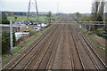
The railway line to London
This is just a little east of the junction with the line to Birmingham.
Image: © Bill Boaden
Taken: 2 Apr 2011
0.16 miles
6
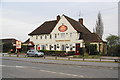
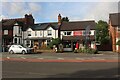
The Radford Bank, Stafford
Situated on Radford Bank. It is worth visiting as a carvery rather than a pub.
Image: © Bill Boaden
Taken: 2 Apr 2011
0.18 miles
7
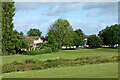
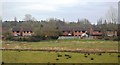
Radford Meadows near Queensville, Stafford
The meadows by the River Penk here are well maintained and open to the public. The line of rough vegetation in the foreground shows the position of the Rickerscote Drain, which flows into the River Penk 125 metres to the north-east (off to the right). The housing is in Lancing Avenue.
Image: © Roger Kidd
Taken: 5 Aug 2015
0.20 miles


10
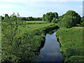
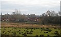
River Penk and meadows near Baswich, Stafford
Looking north from Radford Bridge (footbridge). The flood plain meadows by the River Penk here are open for public use, and are an attractive well maintained facility. The Staffordshire and Worcestershire Canal passes through the trees by the right edge of the image. Bright evening sunlight seems to accentuate the early summer colours.
The River Penk rises in Tettenhall Wood near Wolverhampton. It flows through Coven and Penkridge, joining the River Sow east of Stafford, (about a mile ahead). Almost its whole course is within the county of Staffordshire. The River Penk is 22 miles (36km) in length.
Image: © Roger Kidd
Taken: 20 Jun 2010
0.21 miles