IMAGES TAKEN NEAR TO
Nimrod Avenue, STAFFORD, ST16 3WU
Introduction
This page details the photographs taken nearby to Nimrod Avenue, ST16 3WU by members of the Geograph project.
The Geograph project started in 2005 with the aim of publishing, organising and preserving representative images for every square kilometre of Great Britain, Ireland and the Isle of Man.

There are currently over 7.5m images from over14,400 individuals and you can help contribute to the project by visiting https://www.geograph.org.uk
Image Map
Images are licensed for reuse under creativecommons.org/licenses/by-sa/2.0
Notes
- Clicking on the map will re-center to the selected point.
- The higher the marker number, the further away the image location is from the centre of the postcode.
Image Listing (7 Images Found)
Images are licensed for reuse under creativecommons.org/licenses/by-sa/2.0
Image
Details
Distance
1
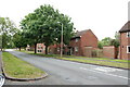
Beacon side Close, Beaconside, Stafford
Image: © Mick Malpass
Taken: 17 Jul 2011
0.18 miles
2
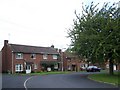
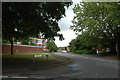
Houses Off Trenchard Road, Beaconside, Stafford
Image: © Geoff Pick
Taken: 15 Sep 2010
0.20 miles
3
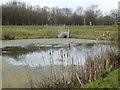
Pond at MOD Stafford
It appears to be a reservoir related to the drainage system.
Image: © Rod Allday
Taken: 30 Mar 2018
0.21 miles
5
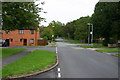
Trenchard Avenue, Stafford
Trechard Ave looking downhill, out of town. The housing was originally built for RAF personnell but is now used by hospital staff, private and rented.
Image: © Stephen Pearce
Taken: 23 Oct 2006
0.21 miles
6
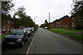
Tedder Road, Stafford
Tedder Road in Stafford. The housing used to be for RAF personnel and much of this road still is for military staff although a lot of the housing has gone over to health service workers or private/rented.
Image: © Stephen Pearce
Taken: 23 Oct 2006
0.22 miles