
IMAGES TAKEN NEAR TO
Fancy Walk, STAFFORD, ST16 3AZ
Introduction
This page details the photographs taken nearby to Fancy Walk, ST16 3AZ by members of the Geograph project.
The Geograph project started in 2005 with the aim of publishing, organising and preserving representative images for every square kilometre of Great Britain, Ireland and the Isle of Man.

There are currently over 7.5m images from over14,400 individuals and you can help contribute to the project by visiting https://www.geograph.org.uk
Image Map
Images are licensed for reuse under creativecommons.org/licenses/by-sa/2.0
Notes
- Clicking on the map will re-center to the selected point.
- The higher the marker number, the further away the image location is from the centre of the postcode.
Image Listing (77 Images Found)
Images are licensed for reuse under creativecommons.org/licenses/by-sa/2.0
Image
Details
Distance
1
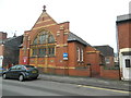
"The Church in Rowley Street"
Joint Methodist & Anglican. Originally a Wesleyan Mission Hall.
Image: © John Lord
Taken: 6 Feb 2017
0.05 miles
2
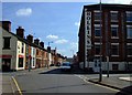
Rowley Street
Looking along Rowley Street towards Christchurch. The Hollins Business Centre to the right is a former shoe manufactory - Stafford was one of the centres of the shoe trade from the mid C19th up to the 1980s.
Image: © Simon Huguet
Taken: 26 Jul 2008
0.05 miles
3
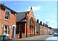
Christchurch, Rowley Street
Formerly a Wesleyan Mission Hall built for the shoe factory workers who lived in the terraced streets around it this C19th church is now shared by the Stafford Team Ministry [Church of England] and the Methodists.
Image: © Simon Huguet
Taken: 26 Jul 2008
0.07 miles
5
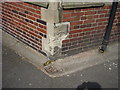
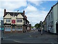
Ordnance Survey bench-mark on Waggon and Horses
This bench mark appears on the 1881 town plans with a height of 254.9ft above sea level (Liverpool datum). It was relevelled by the Ordnance Survey in 1969 with a height of 77.5509m above sea level (Newlyn datum). This former coaching inn originally stood at the junction of the Manchester and Chester roads, but the main road junction has since been moved to the NNW, and the pub is now at the junction of Greyfriars and Stone Walk.
Image: © Shantavira
Taken: 27 Jul 2013
0.07 miles
8
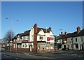
The Wagon and Horses
Isolated on its own island between the old Stone Road, Greyfriars and the Stone Road roundabout the Wagon and Horses lies empty and boarded up.
Image: © Simon Huguet
Taken: 18 Jan 2009
0.08 miles
9
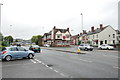
Road Complex around the Waggon & Horses, Greyfriars, Stafford
Image: © Mick Malpass
Taken: 17 Jul 2011
0.08 miles
10
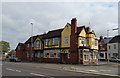
The Waggon & Horses, Stafford
On Greyfriars.
Image: © JThomas
Taken: 7 Sep 2019
0.09 miles