Ordnance Survey bench-mark on Waggon and Horses
Introduction
The photograph on this page of Ordnance Survey bench-mark on Waggon and Horses by Shantavira as part of the Geograph project.
The Geograph project started in 2005 with the aim of publishing, organising and preserving representative images for every square kilometre of Great Britain, Ireland and the Isle of Man.

There are currently over 7.5m images from over 14,400 individuals and you can help contribute to the project by visiting https://www.geograph.org.uk
Ordnance Survey bench-mark on Waggon and Horses
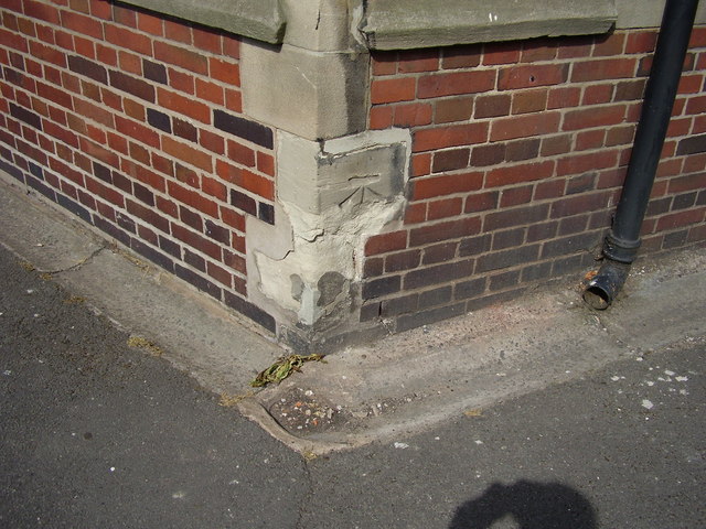
Image: © Shantavira Taken: 27 Jul 2013
This bench mark appears on the 1881 town plans with a height of 254.9ft above sea level (Liverpool datum). It was relevelled by the Ordnance Survey in 1969 with a height of 77.5509m above sea level (Newlyn datum). This former coaching inn originally stood at the junction of the Manchester and Chester roads, but the main road junction has since been moved to the NNW, and the pub is now at the junction of Greyfriars and Stone Walk.
Images are licensed for reuse under creativecommons.org/licenses/by-sa/2.0
Image Location
Latitude
52.814738
Longitude
-2.12266