IMAGES TAKEN NEAR TO
Beechway, STAFFORD, ST16 1NF
Introduction
This page details the photographs taken nearby to Beechway, ST16 1NF by members of the Geograph project.
The Geograph project started in 2005 with the aim of publishing, organising and preserving representative images for every square kilometre of Great Britain, Ireland and the Isle of Man.

There are currently over 7.5m images from over14,400 individuals and you can help contribute to the project by visiting https://www.geograph.org.uk
Image Map
Images are licensed for reuse under creativecommons.org/licenses/by-sa/2.0
Notes
- Clicking on the map will re-center to the selected point.
- The higher the marker number, the further away the image location is from the centre of the postcode.
Image Listing (10 Images Found)
Images are licensed for reuse under creativecommons.org/licenses/by-sa/2.0
Image
Details
Distance
1
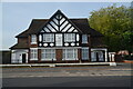
The former pub, The Antelope Inn, on Stone Road, Stafford
The Antelope Inn was closed in 2011. A planning application was approved by Stafford Borough Council in 2014 for a private motorcycle museum on the ground floor with the first floor remaining as private residential accommodation. The building is on the junction of Stone Road and Charles Cotton Street.
Image: © Rod Grealish
Taken: 17 Oct 2023
0.09 miles
2

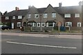
The Co-operative at junction of Stone Road and Charles Cotton Street, Stafford
One of several Co-operative stores in Stafford. The store is principally a food store with the additional services of a defibrillator, cash machine, outdoor recycling point, food bank and a bicycle repair station. The street is named for Charles Cotton a poet and friend of Isaak Newton author of The Compleat Angler
Image: © Rod Grealish
Taken: 17 Oct 2023
0.09 miles
5
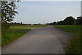
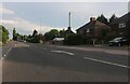
Stafford Common from Stone Road Stafford
The image shows the southernmost part of Stafford Common. The Common is owned by the Stafford Common Land Trustees. It is used for car boot sales, horse and cattle grazing and recreation. Behind the line of trees on the right in a shallow cutting is the route of the former Uttoxeter-Stafford railway line opened in 1867 and closed in sections between 1939 and 1975. The final section between Stafford and the RAF Stafford supply depot was closed in March 1975, There was a station called Stafford Common in the far corner of the Common. Common Road runs at the eastern side of the Common where the industrial buildings can be seen.
Image: © Rod Grealish
Taken: 17 Oct 2023
0.14 miles
6
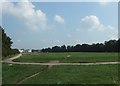
Stafford Common
Looking across the Common from the Stone Road side.
The Commons Registration Act 1965 defines common land as ‘land subject to rights of common (as defined in the Act) whether those rights are exercisable at all times or only during limited periods’, and ‘waste land of a manor not subject to rights of common’. Common land generally has open access rights for the public.
Stafford Common extends to 62 ha.(approx 150ac.) and is regularly used for horse shows and car boot sales, hosts cross country running races and is well walked by local residents. It is also used for grazing cattle and horses.
The trees to the right, along the southern edge of the Common, follow the line of the old Stafford to Uttoxeter branch railway. There was a small station, called Stafford Common, near the white buildings on the horizon where the track also sent out a spur to serve the nearby saltworks.
Image: © Simon Huguet
Taken: 18 Sep 2008
0.17 miles
7
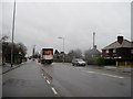
Stone Road, Stafford
Taken on the Stone Road, looking towards Stafford. I was standing beside a grassy area which I am told is Stafford Common, although that name does not appear on the map. It is used for enormous car-boot sales, amongst other things.
Image: © Tricia Neal
Taken: 23 Dec 2013
0.20 miles
8
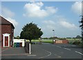
Entrance to Sir Graham Balfour High School
The school was recently rebuilt and is blessed with very large playing fields.
The house on the left displays the impressive assortment of wheelie bins Stafford residents have to use for their rubbish [green], re-cycling [blue] and garden waste [brown].
Image: © Simon Huguet
Taken: 18 Sep 2008
0.21 miles
9
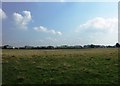
Stafford Common
Looking across Stafford Common towards the Astonfields Industrial Estate.
Current development proposals for Stafford include potential land for houses identified as '149 acres off Stone Road'. Could this be it?
Image: © Simon Huguet
Taken: 18 Sep 2008
0.22 miles