Stafford Common from Stone Road Stafford
Introduction
The photograph on this page of Stafford Common from Stone Road Stafford by Rod Grealish as part of the Geograph project.
The Geograph project started in 2005 with the aim of publishing, organising and preserving representative images for every square kilometre of Great Britain, Ireland and the Isle of Man.

There are currently over 7.5m images from over 14,400 individuals and you can help contribute to the project by visiting https://www.geograph.org.uk
Stafford Common from Stone Road Stafford
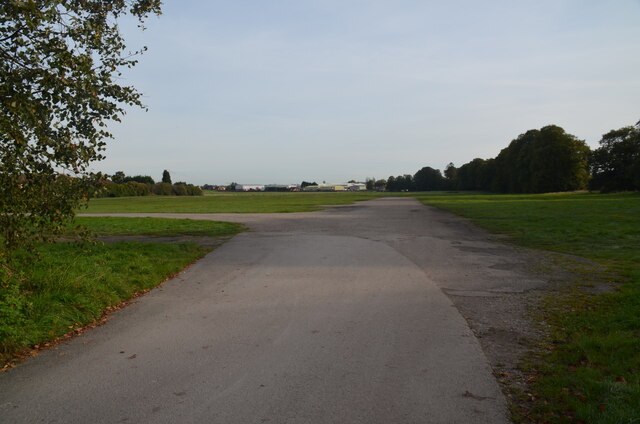
Image: © Rod Grealish Taken: 17 Oct 2023
The image shows the southernmost part of Stafford Common. The Common is owned by the Stafford Common Land Trustees. It is used for car boot sales, horse and cattle grazing and recreation. Behind the line of trees on the right in a shallow cutting is the route of the former Uttoxeter-Stafford railway line opened in 1867 and closed in sections between 1939 and 1975. The final section between Stafford and the RAF Stafford supply depot was closed in March 1975, There was a station called Stafford Common in the far corner of the Common. Common Road runs at the eastern side of the Common where the industrial buildings can be seen.
Images are licensed for reuse under creativecommons.org/licenses/by-sa/2.0
Image Location
Latitude
52.819861
Longitude
-2.123416