
IMAGES TAKEN NEAR TO
Saltersford Rise, STONE, ST15 8ZY
Introduction
This page details the photographs taken nearby to Saltersford Rise, ST15 8ZY by members of the Geograph project.
The Geograph project started in 2005 with the aim of publishing, organising and preserving representative images for every square kilometre of Great Britain, Ireland and the Isle of Man.

There are currently over 7.5m images from over14,400 individuals and you can help contribute to the project by visiting https://www.geograph.org.uk
Image Map
Images are licensed for reuse under creativecommons.org/licenses/by-sa/2.0
Notes
- Clicking on the map will re-center to the selected point.
- The higher the marker number, the further away the image location is from the centre of the postcode.
Image Listing (112 Images Found)
Images are licensed for reuse under creativecommons.org/licenses/by-sa/2.0
Image
Details
Distance
2
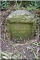
Old Milestone by Mount Road, Edge Hill, Stone Parish
Stone post (plate lost) by the UC road, in parish of STONE (STAFFORD District), West of Edge Hill, on roadside. Erected by the Rugeley & Stone turnpike trust in the 19th century.
Inscription once read:- : (LONDON 136 / LICHFIELD 23 / STONE 1 / NEWCASTLE 7½) :
Milestone Society National ID: ST_SNNC01.
Image: © J Higgins
Taken: 1 Jan 2003
0.08 miles
3
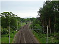
West Coast Main Line, Stone
Looking north west from the bridge on Mount Road.
Image: © JThomas
Taken: 1 Jun 2019
0.10 miles
4
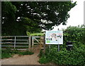
Footpath off Mount Road
Onto Stone Common Plot.
Image: © JThomas
Taken: 1 Jun 2019
0.12 miles
5
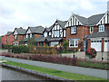
New Housing by the Canal, near Meaford, Staffordshire
Image: © Roger D Kidd
Taken: 21 Aug 2007
0.12 miles
6
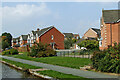
Housing north-west of Stone in Staffordshire
This modern housing by the Trent and Mersey Canal is in Anderton View and Barnton Edge, at the north-western tip of Stone.
Image: © Roger Kidd
Taken: 10 Sep 2014
0.13 miles
7
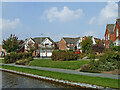
Anderton View houses near Stone in Staffordshire
The modern housing in Anderton View is by the Trent and Mersey Canal. This is at the north-western edge of Stone.
Image: © Roger Kidd
Taken: 10 Sep 2014
0.13 miles
8
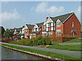
Canalside housing near Meaford in Staffordshire
The housing in Anderton View is by the Trent and Mersey Canal near Meaford Bottom Lock. This is at the north-western edge of Stone.
Image: © Roger Kidd
Taken: 10 Sep 2014
0.14 miles
9

Canalside housing at Stone, Staffordshire
East of the Trent and Mersey Canal, housing in Stone now extends as far as Meaford Locks (by the central autumnal maple tree).
The Trent and Mersey Canal is 93.5 miles in length from Derwent Mouth to Preston Brook. The first sod was cut by Josiah Wedgwood in July 1766 at Middleport (Stoke-on-Trent) and the whole canal was open for business by 1777.
Image: © Roger D Kidd
Taken: 3 Sep 2011
0.14 miles
10
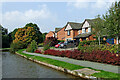
Canalside housing near Meaford in Staffordshire
The housing in Barnton Edge is by the Trent and Mersey Canal near Meaford Bottom Lock. This is at the north-western edge of Stone.
Image: © Roger Kidd
Taken: 10 Sep 2014
0.14 miles