
IMAGES TAKEN NEAR TO
Walton Cross, STONE, ST15 0HF
Introduction
This page details the photographs taken nearby to Walton Cross, ST15 0HF by members of the Geograph project.
The Geograph project started in 2005 with the aim of publishing, organising and preserving representative images for every square kilometre of Great Britain, Ireland and the Isle of Man.

There are currently over 7.5m images from over14,400 individuals and you can help contribute to the project by visiting https://www.geograph.org.uk
Image Map
Images are licensed for reuse under creativecommons.org/licenses/by-sa/2.0
Notes
- Clicking on the map will re-center to the selected point.
- The higher the marker number, the further away the image location is from the centre of the postcode.
Image Listing (35 Images Found)
Images are licensed for reuse under creativecommons.org/licenses/by-sa/2.0
Image
Details
Distance

2
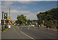
Roundabout, Stone
The Eccleshall Road, B5026, reaches the roundabout at the A34 Stone bypass. On the left is the sign for the Lamb Inn, but the pub itself is set well back from the road, and out of square.
Image: © Derek Harper
Taken: 7 Sep 2012
0.08 miles
5
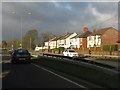
Storm clouds over Stone
Rain clouds seen from the A34 at the Walton roundabout
Image: © Peter Whatley
Taken: 7 Dec 2011
0.09 miles
6
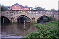
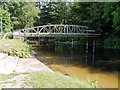
The Old Walton Bridge, Stone
This is a view of the Old Walton Bridge over the River Trent at Stone. There used to be a narrow footbridge that ran along side this single track bridge before a new bridge over the river was built. The new bridge is hidden from view in this picture.
Image: © Stephen Pearce
Taken: 20 Oct 2006
0.11 miles
7
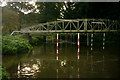
Slalom Course, River Trent, Stone
This is the River Trent at Stone. A popular place for canoeists this course and river has produced some very high standards including one or two national champions.
Image: © Stephen Pearce
Taken: 20 Oct 2006
0.11 miles
8
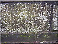
Benchmark on Walton Bridge
This benchmark was established in 1844 during the First primary levelling of England & Wales, and was levelled with a height of 288.4600 feet [87.9226 metres] above mean sea level (Liverpool datum). It was included on the Manchester to Gloucester levelling line. The surveyor's description was "No. 200. Bolt in West face of East battlement of Walton Bridge over river Trent ; 1.85 ft. above centre of road" (Public Abstract p.28). It can be found near the middle of the pedestrians-only old bridge, parallel to the newer main road bridge.
Image: © Shantavira
Taken: 15 Nov 2014
0.11 miles
9
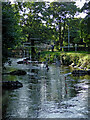
River Trent slalom course in Stone Staffordshire
Looking west in Westbridge Park.
Image: © Roger Kidd
Taken: 29 Jul 2015
0.12 miles
10
Slalom Course River Trent, Stone
Slalom course on the River Trent, near Westbridge Park.
Image: © David Dixon
Taken: 11 Jul 2013
0.12 miles