
IMAGES TAKEN NEAR TO
Egerton Close, STOKE-ON-TRENT, ST11 9NS
Introduction
This page details the photographs taken nearby to Egerton Close, ST11 9NS by members of the Geograph project.
The Geograph project started in 2005 with the aim of publishing, organising and preserving representative images for every square kilometre of Great Britain, Ireland and the Isle of Man.

There are currently over 7.5m images from over14,400 individuals and you can help contribute to the project by visiting https://www.geograph.org.uk
Image Map
Images are licensed for reuse under creativecommons.org/licenses/by-sa/2.0
Notes
- Clicking on the map will re-center to the selected point.
- The higher the marker number, the further away the image location is from the centre of the postcode.
Image Listing (38 Images Found)
Images are licensed for reuse under creativecommons.org/licenses/by-sa/2.0
Image
Details
Distance
1
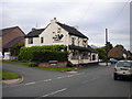
The Black Cock, Blythe Bridge
A pub on Uttoxeter Road near the east end of the village. It has apparently been subject to refurbishment since it was recorded in 2007: see Image
Image: © Richard Vince
Taken: 29 Jun 2013
0.02 miles
4
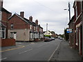
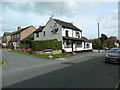
Uttoxeter Road, Blythe Bridge
Near the east end of the village, with The Avenue on the left and the Black Cock pub visible in the centre of the picture.
Image: © Richard Vince
Taken: 29 Jun 2013
0.04 miles
5
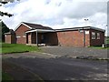
Forsbrook and Blythe Bridge Village Hall
Image: © Ian Calderwood
Taken: 18 May 2007
0.07 miles
6
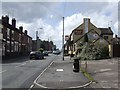
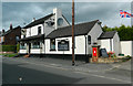
The Black Cock
The Black Cock is on Uttoxeter Road, the main road through Blythe Bridge.
Image: © Ian Calderwood
Taken: 18 May 2007
0.08 miles
9
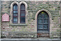
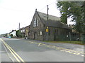
Blythe Bridge Methodist Church
For a wider view of the church see Image The archway inscribed 'Wesleyan' was presumably once a door but nowadays entry is on the east side. The board shows a regular Sunday service at 10am.
Image: © Stephen McKay
Taken: 13 May 2021
0.14 miles
10
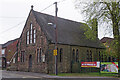
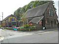
Blythe Bridge Methodist Church
This stone church dates from the 19th century and appears to have a thriving congregation. It is located on Uttoxeter Road in the area once known as Blythe Marsh, a distinct settlement from Blythe Bridge further west. The two have long since coalesced and it is hard to determine where one ends and the other begins but the 'Blythe Bridge' name seems to be generally used for the whole area. Note the banner to the right of the church on the railings of the William Amory Primary School and Nursery which states: 'Let's do it to keep schools open. Book your coronavirus test now'.
Image: © Stephen McKay
Taken: 13 May 2021
0.14 miles