Blythe Bridge Methodist Church
Introduction
The photograph on this page of Blythe Bridge Methodist Church by Stephen McKay as part of the Geograph project.
The Geograph project started in 2005 with the aim of publishing, organising and preserving representative images for every square kilometre of Great Britain, Ireland and the Isle of Man.

There are currently over 7.5m images from over 14,400 individuals and you can help contribute to the project by visiting https://www.geograph.org.uk
Blythe Bridge Methodist Church
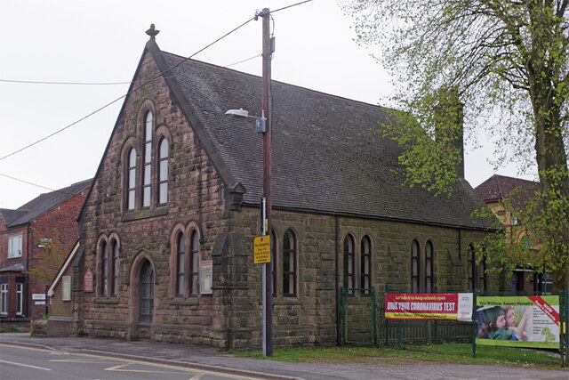
Image: © Stephen McKay Taken: 13 May 2021
This stone church dates from the 19th century and appears to have a thriving congregation. It is located on Uttoxeter Road in the area once known as Blythe Marsh, a distinct settlement from Blythe Bridge further west. The two have long since coalesced and it is hard to determine where one ends and the other begins but the 'Blythe Bridge' name seems to be generally used for the whole area. Note the banner to the right of the church on the railings of the William Amory Primary School and Nursery which states: 'Let's do it to keep schools open. Book your coronavirus test now'.
Images are licensed for reuse under creativecommons.org/licenses/by-sa/2.0
Image Location
Latitude
52.966167
Longitude
-2.059663