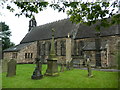
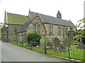
IMAGES TAKEN NEAR TO
Penk Road, STOKE-ON-TRENT, ST11 9BT
Introduction
This page details the photographs taken nearby to Penk Road, ST11 9BT by members of the Geograph project.
The Geograph project started in 2005 with the aim of publishing, organising and preserving representative images for every square kilometre of Great Britain, Ireland and the Isle of Man.

There are currently over 7.5m images from over14,400 individuals and you can help contribute to the project by visiting https://www.geograph.org.uk
Image Map
Images are licensed for reuse under creativecommons.org/licenses/by-sa/2.0
Notes
- Clicking on the map will re-center to the selected point.
- The higher the marker number, the further away the image location is from the centre of the postcode.
Image Listing (30 Images Found)
Images are licensed for reuse under creativecommons.org/licenses/by-sa/2.0
Image
Details
Distance
1
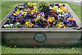
Flowers at the Cheadle Road/Blythe Mount Park Junction
This colourful flowerbed is located where Blythe Mount Park leads off Cheadle Road in Blythe Bridge. The plaque states that planting was sponsored by the Care and Fun Club Day Nursery.
Image: © Stephen McKay
Taken: 13 May 2021
0.09 miles
2
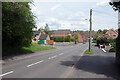
Cheadle Road, Forsbrook
Both Blythe Bridge and Forsbrook together form Forsbrook Parish and over the years the two have fused, so it is not easy to determine exactly where one ends and the other begins. However, the green sign here close to the junction of Cheadle Road and Caverswall Old Road announces arrival in Forsbrook so the boundary is presumably somewhere in this immediate area.
Image: © Stephen McKay
Taken: 13 May 2021
0.09 miles
3
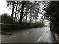
Cheadle Road in Forsbrook
Looking towards Blythe Bridge on a foul February afternoon.
Image: © Jonathan Clitheroe
Taken: 2 Feb 2021
0.11 miles
4
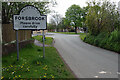
Entering Forsbrook
Caverswall Old Road enters the built up area of Forsbrook. Forsbrook, Blythe Bridge and Blythe Marsh were once separate hamlets but have nowadays fused to become effectively one settlement, all part of Forsbrook parish.
Image: © Stephen McKay
Taken: 13 May 2021
0.14 miles
5
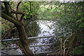
Pond at Blythe Bridge
This small pond is tucked away near the end of Manifold Road and can be viewed from the footpath that runs around the school playing field.
Image: © Stephen McKay
Taken: 13 May 2021
0.17 miles
6
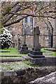
St Peter's Churchyard, Blythe Bridge
With plenty of colourful blossom brightening up the churchyard, the rather dour Victorian church looks less forbidding than it might otherwise do. The church was built 1847-49 originally as a chapel of ease to serve the three related settlements of Forsbrook, Blythe Bridge and Blythe Marsh; it is correctly known as St Peter's Forsbrook although it is located on Cheadle Road in Blythe Bridge.
Image: © Stephen McKay
Taken: 13 May 2021
0.18 miles
7
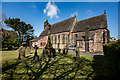
St Peter's Church, Blythe Bridge
http://trigpointing.uk/trig/9317
Image: © Brian Deegan
Taken: 5 May 2018
0.18 miles
8
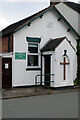
Forsbrook Methodist Church
This small church was built in 1856 as a Primitive Methodist chapel on what was subsequently named Chapel Street. Primitive Methodism was first established in north Staffordshire in the early 19th century and the first chapel was built at Tunstall in 1812. This form of Methodism, whose followers believed their worship was closer the ways of John Wesley, the founder of Methodism, was to spread widely, notably to the USA and Australia. In 1932 the Primitive Methodists merged with the Wesleyan Methodist Church and the United Methodists to form the Methodist Church of Great Britain. Today this church in Forsbrook is linked with the larger former Wesleyan chapel in Blythe Bridge.
Image: © Stephen McKay
Taken: 13 May 2021
0.18 miles