St Peter's Churchyard, Blythe Bridge
Introduction
The photograph on this page of St Peter's Churchyard, Blythe Bridge by Stephen McKay as part of the Geograph project.
The Geograph project started in 2005 with the aim of publishing, organising and preserving representative images for every square kilometre of Great Britain, Ireland and the Isle of Man.

There are currently over 7.5m images from over 14,400 individuals and you can help contribute to the project by visiting https://www.geograph.org.uk
St Peter's Churchyard, Blythe Bridge
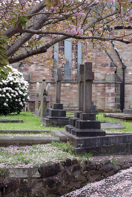
Image: © Stephen McKay Taken: 13 May 2021
With plenty of colourful blossom brightening up the churchyard, the rather dour Victorian church looks less forbidding than it might otherwise do. The church was built 1847-49 originally as a chapel of ease to serve the three related settlements of Forsbrook, Blythe Bridge and Blythe Marsh; it is correctly known as St Peter's Forsbrook although it is located on Cheadle Road in Blythe Bridge.
Images are licensed for reuse under creativecommons.org/licenses/by-sa/2.0
Image Location
Latitude
52.967605
Longitude
-2.059367