
IMAGES TAKEN NEAR TO
Leek Road, STOKE-ON-TRENT, ST10 3HW
Introduction
This page details the photographs taken nearby to Leek Road, ST10 3HW by members of the Geograph project.
The Geograph project started in 2005 with the aim of publishing, organising and preserving representative images for every square kilometre of Great Britain, Ireland and the Isle of Man.

There are currently over 7.5m images from over14,400 individuals and you can help contribute to the project by visiting https://www.geograph.org.uk
Image Map
Images are licensed for reuse under creativecommons.org/licenses/by-sa/2.0
Notes
- Clicking on the map will re-center to the selected point.
- The higher the marker number, the further away the image location is from the centre of the postcode.
Image Listing (18 Images Found)
Images are licensed for reuse under creativecommons.org/licenses/by-sa/2.0
Image
Details
Distance
1
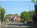
Waterhouses and the A523
The village of Waterhouses, on the A523 between Leek and Ashbourne.
Image: © David Weston
Taken: 21 Sep 2014
0.03 miles
2
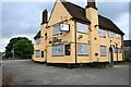
The George
Closed, boarded-up and up for sale, five months ago it was only the latter I think Image
Image: © David Lally
Taken: 1 Aug 2011
0.08 miles
3
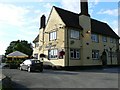
The George
Public house on the A523 trunk road through Waterhouses.
Image: © James Allan
Taken: 24 Aug 2008
0.09 miles
4
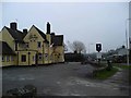
The George, Waterhouses
For sale at the time of this image.
Image: © Gordon Brown
Taken: 20 Feb 2011
0.09 miles
5
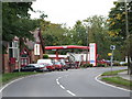
Local industry in Waterhouses
WG Tankers, a workshop specialising in bulk powder tanks for the limestone and cement haulage businesses in the area around Waterhouses, where Lafarge own and operate the Caldon Quarries and cement works. A good example of the multiplier effect of a large business in a rural area. Also visible is Waterhouses Methodist Church.
Image: © Maxwell S W Birchenough
Taken: 29 Sep 2008
0.10 miles
6
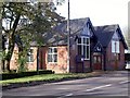
Waterhouses Methodist Church
Part of the Cheadle Methodist Circuit, Waterhouses Methodist Church was originally built in 1823 and rebuilt again in 1905.
Image: © Ian Calderwood
Taken: 30 Oct 2010
0.14 miles
7
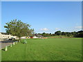
Sports ground, Waterhouses
On the left are recently-built houses of Portland Place. The sports pavilion also looks fairly new.
Image: © David Weston
Taken: 21 Sep 2014
0.14 miles
9
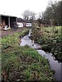
Caldon Mill lade
The mill lade used to channel water from the River Hamps into the mill pool at Caldon Mill.
Image: © Ian Calderwood
Taken: 30 Oct 2010
0.17 miles
10
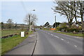
A523 out of Waterhouses
Looking west and taken from opposite The George (now closed) and the southern end of Waterfall Lane.
Image: © Trevor Harris
Taken: 24 Apr 2021
0.17 miles