
IMAGES TAKEN NEAR TO
Aalten Avenue, CANVEY ISLAND, SS8 7QP
Introduction
This page details the photographs taken nearby to Aalten Avenue, SS8 7QP by members of the Geograph project.
The Geograph project started in 2005 with the aim of publishing, organising and preserving representative images for every square kilometre of Great Britain, Ireland and the Isle of Man.

There are currently over 7.5m images from over14,400 individuals and you can help contribute to the project by visiting https://www.geograph.org.uk
Image Map
Images are licensed for reuse under creativecommons.org/licenses/by-sa/2.0
Notes
- Clicking on the map will re-center to the selected point.
- The higher the marker number, the further away the image location is from the centre of the postcode.
Image Listing (44 Images Found)
Images are licensed for reuse under creativecommons.org/licenses/by-sa/2.0
Image
Details
Distance
1
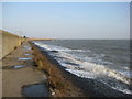
Canvey sea wall
Looking east towards Canvey Point. in the far distance is Southend.
Image: © Ron Galliers
Taken: 31 Jan 2009
0.09 miles
2
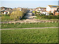
Canvey Island: Bommel Avenue
Wikipedia states that "Approximately one-third of Canvey's streets have names of Dutch origin." This is due to the amount of Dutch skill and manpower that went into the island's land reclamation efforts of the 17th century. Well, Bommel Avenue, here, almost the nearest street to the south-eastern corner of the island, is an illustration. This is the view from the top of the sea defence wall.
(The co-ordinates, not to mention the cartography, on the Ordnance Survey 1:50,000 scale mapping are somewhat flaky here, and the subject and photographer locations have consequently been taken from the "Where's the path?" website, and checked against larger scale OS mapping. About the first 10 metres of Bommel Avenue are in this grid square.)
Image: © Nigel Cox
Taken: 8 Mar 2011
0.09 miles
3
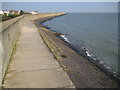
Canvey Island: Sea defence wall
This is the view in the opposite direction to Image Aerial satellite imagery taken at low tide shows that the steps in the distance leading down into the water, now at high tide, actually lead to a small sandy beach that is only exposed at low tide.
Image: © Nigel Cox
Taken: 8 Mar 2011
0.10 miles
4
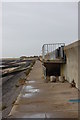
Canvey Island Seawall
Leigh Beck: View up-river from the south-east corner of the island
Image: © John Myers
Taken: 14 Feb 2012
0.10 miles
5
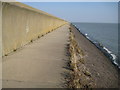
Canvey Island: Sea defence wall at Leigh Beck
This is the massive sea defence wall looking towards the south-eastern corner of Canvey Island. Image is just visible in the distance, in this shot taken at high tide.
Image: © Nigel Cox
Taken: 8 Mar 2011
0.11 miles
6
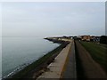
Leigh Beck, Canvey Island
This is the sea wall at Leigh Beck Canvey Island the picture was taken looking upstream
Image: © Glyn Baker
Taken: 11 Feb 2006
0.11 miles
7
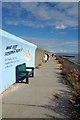
Fishermen's Tale Immortalised
The mural commemorates the landing of a 47Kg Cod by 71 year old Bert Williams in March 2016
(it does not say where the fish was caught!).
Image: © Glyn Baker
Taken: 9 Oct 2016
0.11 miles
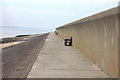
9
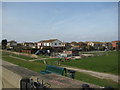
Leigh Beck pumping station
Constant maintenance of the drainage system is essential to keep the Island from flooding.
Image: © Ron Galliers
Taken: 17 Mar 2009
0.11 miles
10
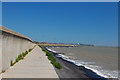
Sea Wall at Leigh Beck
Looking towards the south eastern corner of Canvey Island with Southend in the background.
Image: © Trevor Harris
Taken: 3 Jun 2011
0.12 miles