
IMAGES TAKEN NEAR TO
Beech Road, SS7 2FW
Introduction
This page details the photographs taken nearby to Beech Road, SS7 2FW by members of the Geograph project.
The Geograph project started in 2005 with the aim of publishing, organising and preserving representative images for every square kilometre of Great Britain, Ireland and the Isle of Man.

There are currently over 7.5m images from over14,400 individuals and you can help contribute to the project by visiting https://www.geograph.org.uk
Image Map
Images are licensed for reuse under creativecommons.org/licenses/by-sa/2.0
Notes
- Clicking on the map will re-center to the selected point.
- The higher the marker number, the further away the image location is from the centre of the postcode.
Image Listing (46 Images Found)
Images are licensed for reuse under creativecommons.org/licenses/by-sa/2.0
Image
Details
Distance
1
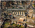
Aerial view of Hadleigh light industrial area
This shows the light industrial area between the London Road (A13) at the upper right, and Beech Road running along the left side. At the top right, on either side of the London Road are the Castle Pub (left) and the Ancora restaurant (right). Both are worth a visit.
Image: © Edward Clack
Taken: 16 Oct 1987
0.05 miles
2
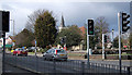
Hadleigh, Essex
This photo is of the eastern end of the dual carriageway, where the A13 (London Road) splits. The traffic lights control a pedestrian crossing and traffic coming from the north. In the background is Hadleigh Church (St James the Less).
Image: © John Rostron
Taken: 19 Feb 2010
0.09 miles
3
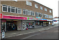
Shops at Hadleigh
These shops are on the southern side of the London Road (A13) just to the east of where splits either side of Hadleigh Church Image
Image: © John Rostron
Taken: 19 Feb 2010
0.09 miles
6
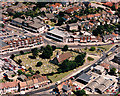
Aerial view of Hadleigh town centre
Here, the London Road (A13) splits into two branches which re-unite at the far right of the picture. The road running off up and centre-left is Rectory Road. The church in the centre is the parish church of St James the Less. Most of the buildings lining the northern branch of the London Road, and Rectory Road are shops. The building at the bottom centre is the Castle Pub. There is a public car park centre-left.
Image: © Edward Clack
Taken: 10 Jul 1987
0.11 miles
7
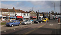
Shops at Hadleigh
These shops are on the northern side of the London Road (A13) just to the east of where splits either side of Hadleigh Church Image
Image: © John Rostron
Taken: 19 Feb 2010
0.11 miles
9
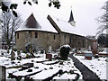
Hadleigh Church
Hadleigh Church, dating from Norman times, pictured in the April snow 2008
Image: © gary faux
Taken: 6 Apr 2008
0.12 miles
10
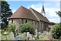
St James the Less, Hadleigh
With many features dating back to Norman times (such as the semi-circular apse in the forefront of the photo), St James the Less predates the nearby Hadleigh Castle.
Image: © Trevor Harris
Taken: 1 Aug 2008
0.12 miles