Aerial view of Hadleigh light industrial area
Introduction
The photograph on this page of Aerial view of Hadleigh light industrial area by Edward Clack as part of the Geograph project.
The Geograph project started in 2005 with the aim of publishing, organising and preserving representative images for every square kilometre of Great Britain, Ireland and the Isle of Man.

There are currently over 7.5m images from over 14,400 individuals and you can help contribute to the project by visiting https://www.geograph.org.uk
Aerial view of Hadleigh light industrial area
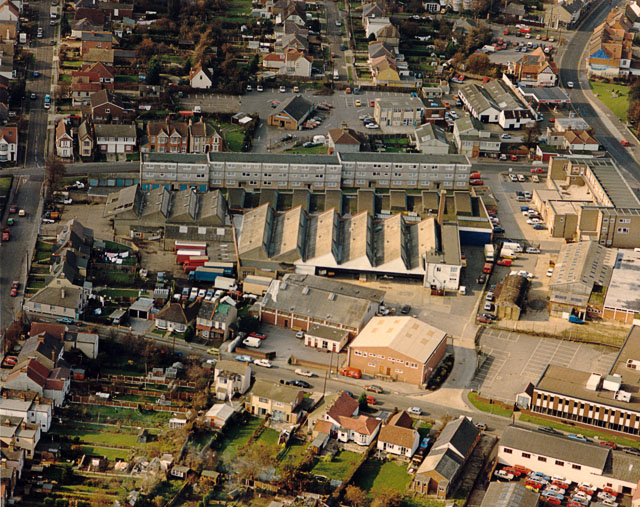
Image: © Edward Clack Taken: 16 Oct 1987
This shows the light industrial area between the London Road (A13) at the upper right, and Beech Road running along the left side. At the top right, on either side of the London Road are the Castle Pub (left) and the Ancora restaurant (right). Both are worth a visit.
Images are licensed for reuse under creativecommons.org/licenses/by-sa/2.0
Image Location


Leaflet Map data © OpenStreetMap
Latitude
51.551736
Longitude
0.610867