Aerial view of Hadleigh town centre
Introduction
The photograph on this page of Aerial view of Hadleigh town centre by Edward Clack as part of the Geograph project.
The Geograph project started in 2005 with the aim of publishing, organising and preserving representative images for every square kilometre of Great Britain, Ireland and the Isle of Man.

There are currently over 7.5m images from over 14,400 individuals and you can help contribute to the project by visiting https://www.geograph.org.uk
Aerial view of Hadleigh town centre
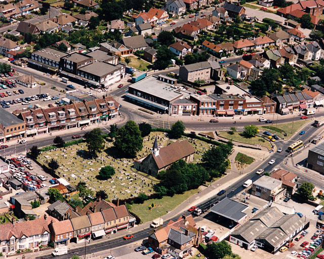
Image: © Edward Clack Taken: 10 Jul 1987
Here, the London Road (A13) splits into two branches which re-unite at the far right of the picture. The road running off up and centre-left is Rectory Road. The church in the centre is the parish church of St James the Less. Most of the buildings lining the northern branch of the London Road, and Rectory Road are shops. The building at the bottom centre is the Castle Pub. There is a public car park centre-left.
Images are licensed for reuse under creativecommons.org/licenses/by-sa/2.0
Image Location


Leaflet Map data © OpenStreetMap
Latitude
51.552849
Longitude
0.609344