
IMAGES TAKEN NEAR TO
Grosvenor Road, RAYLEIGH, SS6 9GA
Introduction
This page details the photographs taken nearby to Grosvenor Road, SS6 9GA by members of the Geograph project.
The Geograph project started in 2005 with the aim of publishing, organising and preserving representative images for every square kilometre of Great Britain, Ireland and the Isle of Man.

There are currently over 7.5m images from over14,400 individuals and you can help contribute to the project by visiting https://www.geograph.org.uk
Image Map
Images are licensed for reuse under creativecommons.org/licenses/by-sa/2.0
Notes
- Clicking on the map will re-center to the selected point.
- The higher the marker number, the further away the image location is from the centre of the postcode.
Image Listing (33 Images Found)
Images are licensed for reuse under creativecommons.org/licenses/by-sa/2.0
Image
Details
Distance
1
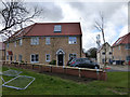
Housing Development
These houses are part of a development on the site that was the Mount Carmel Messianic Centre. Image
Image: © terry joyce
Taken: 9 Feb 2014
0.06 miles
2
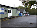
Mt Carmel Messianic Centre
This is located on the junction of Cheapside West and Boston Avenue.
Image: © terry joyce
Taken: 27 Oct 2010
0.06 miles
3
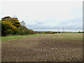
Hidden Stream
These trees and bushes hide the stream that comes from here Image
Image: © terry joyce
Taken: 5 Nov 2010
0.09 miles
4
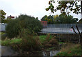
Car Park Stream
This is part of the culvert in Image it flows under part of the parking area of the old Eon building.
Image: © terry joyce
Taken: 27 Oct 2010
0.10 miles
5
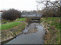
Rayleigh Stream
This stream/brook runs underneath what was the EON building. There are plans to build housing on the site.
Image: © terry joyce
Taken: 21 Feb 2011
0.10 miles
6
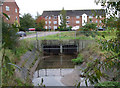
Culvert and Stream
I believe this culvert in Boston Avenue is fed from a number of streams.
It is part of the stream that flows from under the A129 London Road via Maine Crescent.
See Image and Image
It is likely that the overflow from Sweyne Park Pond also flows through this culvert.
Image: © terry joyce
Taken: 27 Oct 2010
0.11 miles
7
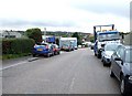
Rawreth Industrial Estate road
This is the road through Rawreth Industrial Estate; it is a no through road.
Image: © terry joyce
Taken: 27 Oct 2010
0.12 miles
9
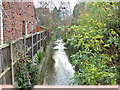
Over the wall
I stuck my head over a wall in Cheapside West and saw this stream that comes from Sweyne Park. It appears from underground drains at this point.It has been concreted as houses have been built either side of it.
It goes underground at the edge of Sweyne Park see Image
Image: © terry joyce
Taken: 26 Nov 2012
0.14 miles
10
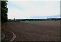
Agriculture and Industry, side by side
This is part of a large field next to Rawreth Industrial Estate
Image: © terry joyce
Taken: 27 Oct 2010
0.15 miles