IMAGES TAKEN NEAR TO
Turner Close, SOUTHEND-ON-SEA, SS3 9TL
Introduction
This page details the photographs taken nearby to Turner Close, SS3 9TL by members of the Geograph project.
The Geograph project started in 2005 with the aim of publishing, organising and preserving representative images for every square kilometre of Great Britain, Ireland and the Isle of Man.

There are currently over 7.5m images from over14,400 individuals and you can help contribute to the project by visiting https://www.geograph.org.uk
Image Map
Images are licensed for reuse under creativecommons.org/licenses/by-sa/2.0
Notes
- Clicking on the map will re-center to the selected point.
- The higher the marker number, the further away the image location is from the centre of the postcode.
Image Listing (8 Images Found)
Images are licensed for reuse under creativecommons.org/licenses/by-sa/2.0
Image
Details
Distance
1
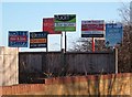
We gotta get out of this place...
...if it's the last thing we ever do. All of these were at the side of one block of flats on Elm Road and I thought it was mildly amusing. Chav heaven.
Image: © Julieanne Savage
Taken: 2 Jan 2007
0.17 miles
2
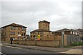
The Woodlands, Elm Road
Currently still shown as "Works" on the map, this housing development uses adapted industrial buildings (like the tower seen here) and new-build on this brown-field site.
Image: © Trevor Harris
Taken: 12 Oct 2014
0.20 miles
3
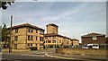
The Woodlands - a recycled works
An old industrial building site transformed
Image: © Chris Morgan
Taken: 12 Jun 2015
0.20 miles
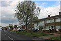
5
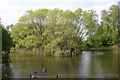
South-western lake, Friars Park, North Shoebury
The two lakes in Friars Park were until 1976 brick pits. 20,000 years ago the gravels of the area were covered with windblown silt or brickearth and from the mid-C19 North Shoebury and nearby Great Wakering became a centre for brickmaking. The last brickworks closed in 2005 and were in Star Lane just to the north of this point.
Image: © David Kemp
Taken: 23 Apr 2014
0.23 miles
6
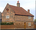
The Old Red House, Shoeburyness, Essex
A famous local landmark, this cottage was built in 1637. It stands on the junction of Wakering Road and Blackgate Road. Supposedly a secret tunnel was built beneath the road during WW2 to ferry troops to and from the seafront. It is said the tunnel ended in the raised area on Rampart Terrace which has now been tarmaced over. There are lots of old wives' tales like this in Shoebury, mostly to do with the MOD. Email if you can shed light on this one.
Image: © Julieanne Savage
Taken: 9 Dec 2006
0.24 miles
7
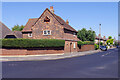
The Red House, Shoeburyness
Quite different to anything surrounding it, this brick-built house on Wakering Road dates from around 1673 and is grade II listed. According to local legend, a tunnel runs from here to the sea shore that might have been used for smuggling or moving troops in the Second World War. See also Image
Image: © Stephen McKay
Taken: 11 Aug 2022
0.24 miles