The Red House, Shoeburyness
Introduction
The photograph on this page of The Red House, Shoeburyness by Stephen McKay as part of the Geograph project.
The Geograph project started in 2005 with the aim of publishing, organising and preserving representative images for every square kilometre of Great Britain, Ireland and the Isle of Man.

There are currently over 7.5m images from over 14,400 individuals and you can help contribute to the project by visiting https://www.geograph.org.uk
The Red House, Shoeburyness
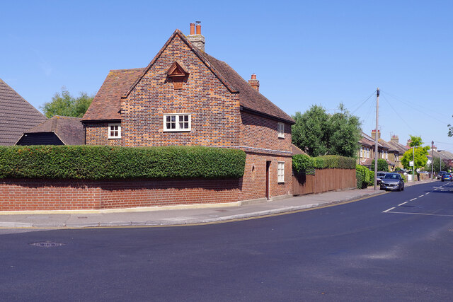
Image: © Stephen McKay Taken: 11 Aug 2022
Quite different to anything surrounding it, this brick-built house on Wakering Road dates from around 1673 and is grade II listed. According to local legend, a tunnel runs from here to the sea shore that might have been used for smuggling or moving troops in the Second World War. See also Image
Images are licensed for reuse under creativecommons.org/licenses/by-sa/2.0
Image Location
Latitude
51.534979
Longitude
0.799253