
IMAGES TAKEN NEAR TO
Saxon Gardens, SOUTHEND-ON-SEA, SS3 9PW
Introduction
This page details the photographs taken nearby to Saxon Gardens, SS3 9PW by members of the Geograph project.
The Geograph project started in 2005 with the aim of publishing, organising and preserving representative images for every square kilometre of Great Britain, Ireland and the Isle of Man.

There are currently over 7.5m images from over14,400 individuals and you can help contribute to the project by visiting https://www.geograph.org.uk
Image Map
Images are licensed for reuse under creativecommons.org/licenses/by-sa/2.0
Notes
- Clicking on the map will re-center to the selected point.
- The higher the marker number, the further away the image location is from the centre of the postcode.
Image Listing (18 Images Found)
Images are licensed for reuse under creativecommons.org/licenses/by-sa/2.0
Image
Details
Distance
1
Staplegrove, Shoeburyness
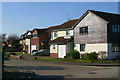
Staplegrove is one of a number of very short cul-de-sacs leading off Aylesbeare.
Image: © David Kemp
Taken: 22 Feb 2018
0.06 miles
2
Holsworthy, Shoeburyness
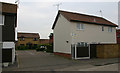
Many of the roads in this gridsquare have for many years been named after places in Devon. However the street sign with its oblong shape and finial is characteristic of Southend alone.
Image: © David Kemp
Taken: 16 Apr 2019
0.06 miles
3
Shoeburyness: Railway line to Southend
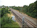
The former London Tilbury and Southend Railway was extended to Shoeburyness in 1884. This is the view looking towards London from the Ness Road bridge.
Image: © Nigel Cox
Taken: 3 Aug 2008
0.11 miles
5
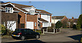
Aylesbeare, Shoeburyness
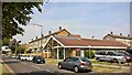
Aylesbeare is a long thoroughfare that winds through the populous development that lies between Bishopsteignton and North Shoebury Road. The road on the right is Rackenford.
Image: © David Kemp
Taken: 22 Feb 2018
0.14 miles
6
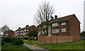
Flats in Delaware Crescent, Shoeburyness
Image: © David Kemp
Taken: 16 Apr 2019
0.16 miles
7
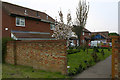
Torrington, Shoeburyness
Torrington is a cul-de-sac whose only vehicular access is from Aylesbeare. However its far end can be reached by pedestrians from nearby Ness Road by means of the footpath shown here. To get from Torrington to Ness Road by car involves a lengthy detour.
Image: © David Kemp
Taken: 16 Apr 2019
0.17 miles
8
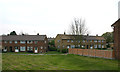
Ness Road, Shoeburyness
Former local authority housing built in the mid-C20.
Image: © David Kemp
Taken: 16 Apr 2019
0.18 miles
9
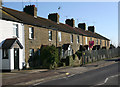
Bridge Cottages, North Shoebury
These cottages situated at right-angles to the railway are one of the few remaining reminders of how North Shoebury looked before becoming intensively developed from the 1980s onwards. I'm uncertain as to whether they were built for employees at the nearby Shoeburyness locomotive depot or for brickfield or farmworkers.
Image: © David Kemp
Taken: 22 Feb 2018
0.19 miles
10
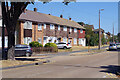
Delaware Road, Shoeburyness
A mixture of terraced houses and flats lines the north side of Delaware Road, seen here from its junction with Blyth Avenue. The housing stock here is obviously local authority built and contrasts noticeably with the private housing to the south.
Image: © Stephen McKay
Taken: 11 Aug 2022
0.23 miles