1
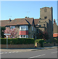
Shoeburyness Methodist Church
The church is in St Andrew's Road. It is not shown on the Ordnance Survey map edition of 1898, but the records of the church in the National Archives date from 1899, so it is reasonable to assume that the church dates from this time.
Image: © Nigel Cox
Taken: 3 Aug 2008
0.07 miles
2
Shoeburyness : United Methodist Church
Image: © Jim Osley
Taken: 28 Jul 2018
0.07 miles
3
Ness Road (B1016)
Image: © JThomas
Taken: 23 Aug 2022
0.07 miles
4
West Road, Shoeburyness
Taken from St Andrew's Road. Once a thriving shopping street, West Road has become a shadow of its former self over the years following the closure of the Shoebury Garrison in 1976 and the opening of the nearby Asda superstore in 1981.
Image: © David Kemp
Taken: 22 Feb 2018
0.09 miles
5
Houses on B1016, Cambridge Town
Image: © JThomas
Taken: 23 Aug 2022
0.09 miles
6
West Road, Shoeburyness
Not so long ago West Road was a thriving shopping street. But with the closure of the Shoebury Garrison in 1976 and the opening the Asda superstore ten minutes' walk away five years later, West Road went into decline. Many of the former retail premises are now occupied by charity shops, fast food outlets or closed altogether. The optimistically and inaccurately named Seaview Road can be seen on the right.
Image: © David Kemp
Taken: 22 Feb 2018
0.09 miles
7
Church hall, St George (RC), Shoeburyness
The church hall stands in St Andrew's Road. Part of the church itself can be seen behind in Ness Road.
Image: © David Kemp
Taken: 23 Apr 2015
0.11 miles
8
St George (RC), Shoeburyness & presbytery
The two buildings face Ness Road.
Image: © David Kemp
Taken: 23 Apr 2015
0.11 miles
9
St George and the English Martyrs
The Catholic church On Ness Road, Shoeburyness. The three figures can be seen in the windows here.
http://www.stgeorgesrcchurch.co.uk/
Image: © Julieanne Savage
Taken: 10 Jan 2007
0.11 miles
10
Church Road, Shoeburyness
Taken outside St Andrew's church (left) near the corner of Richmond Avenue. Although St Andrew's has very much the look of a country church both inside and out it is surrounded on all sides by suburban development such as this.
Image: © David Kemp
Taken: 13 Apr 2014
0.11 miles


