IMAGES TAKEN NEAR TO
High Road, STANFORD-LE-HOPE, SS17 9JB
Introduction
This page details the photographs taken nearby to High Road, SS17 9JB by members of the Geograph project.
The Geograph project started in 2005 with the aim of publishing, organising and preserving representative images for every square kilometre of Great Britain, Ireland and the Isle of Man.

There are currently over 7.5m images from over14,400 individuals and you can help contribute to the project by visiting https://www.geograph.org.uk
Image Map
Images are licensed for reuse under creativecommons.org/licenses/by-sa/2.0
Notes
- Clicking on the map will re-center to the selected point.
- The higher the marker number, the further away the image location is from the centre of the postcode.
Image Listing (10 Images Found)
Images are licensed for reuse under creativecommons.org/licenses/by-sa/2.0
Image
Details
Distance
1
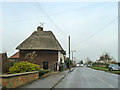
Fishers Cottage, Fobbing
Originally Fishers Farm, a 15th century grade II listed building.
Image: © Robin Webster
Taken: 12 Dec 2013
0.01 miles
2
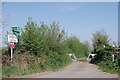
The Start of Marsh Lane
Perusal of Thurrock Councils Rights of Way map reveals the notice about the bridleway ending in 727m is obsolete as there is a cycleway shown on Thurrock Council's map at least as far as the junction with Essex County Council PROW 279-211 at Parting Gut.
Image: © Glyn Baker
Taken: 9 Apr 2020
0.09 miles
4
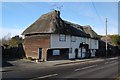
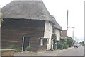
Fishers Cottage, High Road, Fobbing
The cottage may be named after a family, or it might relate to an occupation, as Fobbing was once a fishing village.
Image: © Trevor Harris
Taken: 2 Dec 2008
0.09 miles
5
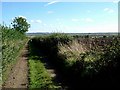
Marsh Lane
This is a view along Marsh Lane Fobbing an “other route with public access” according to my map. The higher ground in the background is South Benfleet which is the other side of Fobbing and Bowers marshes.
Image: © Glyn Baker
Taken: 2 Oct 2005
0.09 miles
6
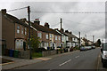
High Road, Fobbing
Looking north with the houses on the west side.
Image: © David Kemp
Taken: 4 Dec 2011
0.11 miles
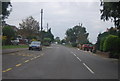
8
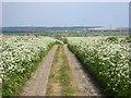
Marsh Lane, Fobbing
A dead-end heading down to the marshes, effectively now just a bridleway unless you are a key holder for the barrier.
Image: © Robin Webster
Taken: 23 Apr 2017
0.16 miles
9
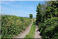
Marsh Lane, Fobbing
Marsh Lane now doubles as a section of the new Thames Estuary Path. Looking east.
Image: © Trevor Harris
Taken: 6 Jun 2014
0.19 miles