
IMAGES TAKEN NEAR TO
Markhams, STANFORD-LE-HOPE, SS17 7EP
Introduction
This page details the photographs taken nearby to Markhams, SS17 7EP by members of the Geograph project.
The Geograph project started in 2005 with the aim of publishing, organising and preserving representative images for every square kilometre of Great Britain, Ireland and the Isle of Man.

There are currently over 7.5m images from over14,400 individuals and you can help contribute to the project by visiting https://www.geograph.org.uk
Image Map
Images are licensed for reuse under creativecommons.org/licenses/by-sa/2.0
Notes
- Clicking on the map will re-center to the selected point.
- The higher the marker number, the further away the image location is from the centre of the postcode.
Image Listing (6 Images Found)
Images are licensed for reuse under creativecommons.org/licenses/by-sa/2.0
Image
Details
Distance
1
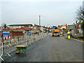
The Sorrells is closed for works
The building with the low pitched roof on the left is the Catcracker pub, closed and boarded up. This was named after the catalytic cracker at Coryton oil refinery.
Image: © Robin Webster
Taken: 12 Dec 2013
0.19 miles
2
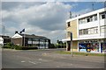
Corringham Cop Shop
The police Station in Corringham is close to the shopping centre.
Image: © Glyn Baker
Taken: 19 May 2011
0.20 miles
3
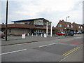
The Catcracker
A pub at the eastern end of The Sorrells.
Image: © Ron Galliers
Taken: 31 Jul 2008
0.20 miles
4
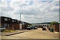
Briceway
An area of housing typical of Corringham the shot was taken looking roughly towards Image]
Image: © Glyn Baker
Taken: 19 May 2011
0.22 miles
5
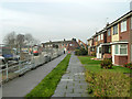
First houses in The Sorrells
These are numbered in the sequence for the road to the right around the corner ahead. They used to face directly on to a roundabout on The Manorway (A1014), but work is in progress on the left removing the roundabout to a different position further away. This was part of the building of a new access road down to the marshes and a new port on the site of the former Shell oil refinery.
Image: © Robin Webster
Taken: 12 Dec 2013
0.24 miles
6
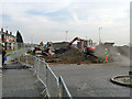
Roadworks, A1014
This is work to do with moving the road arrangement and roundabout here. This was part of the building of a new access road down to the marshes and the new port on the site of the former Shell oil refinery.
Image: © Robin Webster
Taken: 12 Dec 2013
0.24 miles