
IMAGES TAKEN NEAR TO
Waterfront Walk, BASILDON, SS14 3UG
Introduction
This page details the photographs taken nearby to Waterfront Walk, SS14 3UG by members of the Geograph project.
The Geograph project started in 2005 with the aim of publishing, organising and preserving representative images for every square kilometre of Great Britain, Ireland and the Isle of Man.

There are currently over 7.5m images from over14,400 individuals and you can help contribute to the project by visiting https://www.geograph.org.uk
Image Map
Images are licensed for reuse under creativecommons.org/licenses/by-sa/2.0
Notes
- Clicking on the map will re-center to the selected point.
- The higher the marker number, the further away the image location is from the centre of the postcode.
Image Listing (14 Images Found)
Images are licensed for reuse under creativecommons.org/licenses/by-sa/2.0
Image
Details
Distance
1
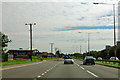
A127 - turning for Pipps Hill Road North
The Southend Arterial Road, eastbound. The 'North' of the side turning implies there was once a 'South', but this has been eliminated as a junction here in the development of Basildon. When the Arterial Road was built in the 1930s it cut across many north-south lanes, creating crossroads, but these have now all been blocked off as crossings.
Image: © Robin Webster
Taken: 22 Jul 2012
0.05 miles
2
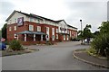
Premier Inn, Basildon
The hotel, on the site of the former Pipp's Hill Country Club, is just north of Basildon's Festival Leisure Park.
Image: © Trevor Harris
Taken: 28 Aug 2008
0.06 miles
4
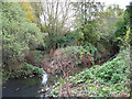
Tributary, River Crouch
This stream is a tributary of the River Crouch. This section first surfaces in a culvert near Butneys (Basildon) and flows through Gloucester Park. It joins the Crouch near Crays Hill. The smaller stream from the left is the overflow from Aquatels Lake. Image
Image: © terry joyce
Taken: 6 Nov 2011
0.11 miles
5
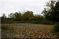
Long Forgotten
This is a car park next to the Premier Inn in Festival Park, Basildon. Access is over a bridge that spans a tributary of the River Crouch.
Image: © terry joyce
Taken: 6 Nov 2011
0.11 miles
6
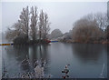
Frozen Lake
The northern end of the lake beside Festival Leisure Park, heavily frozen after a few very cold days and nights.
Image: © John Allan
Taken: 12 Dec 2012
0.12 miles
7
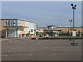
Festival Leisure Park - Basildon
Basildon's Festival Leisure Park is an important leisure destination for people from all over south Essex. The park has a large multi-screen cinema a bowling alley, restaurants and bars to suit everyone and also hotel accommodation.
Image: © Andrew Pickess
Taken: 7 Sep 2005
0.13 miles
8
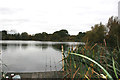
Aquatels Lake
This is a fishing lake of around 30 acres next to the Festival Leisure Park in Basildon.
Image: © terry joyce
Taken: 6 Nov 2011
0.15 miles
10
Behind Bas Vegas
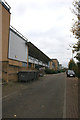
This is the access road to some of the buildings in the Festival Leisure Park, Basildon, otherwise known as Bas Vegas. The road is shown on the map as Waterfront Walk previously, Pipps Hill Road South.
Image: © terry joyce
Taken: 6 Nov 2011
0.17 miles