IMAGES TAKEN NEAR TO
Common Road, SALISBURY, SP5 2RE
Introduction
This page details the photographs taken nearby to Common Road, SP5 2RE by members of the Geograph project.
The Geograph project started in 2005 with the aim of publishing, organising and preserving representative images for every square kilometre of Great Britain, Ireland and the Isle of Man.

There are currently over 7.5m images from over14,400 individuals and you can help contribute to the project by visiting https://www.geograph.org.uk
Image Map
Images are licensed for reuse under creativecommons.org/licenses/by-sa/2.0
Notes
- Clicking on the map will re-center to the selected point.
- The higher the marker number, the further away the image location is from the centre of the postcode.
Image Listing (14 Images Found)
Images are licensed for reuse under creativecommons.org/licenses/by-sa/2.0
Image
Details
Distance
3
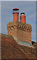
Leaden advertising on house in Common Road, Whiteparish
I don't think I've seen this kind of thing before. Is this the name of the person who did the lead work, or the owner of the house?
Image: © Peter Facey
Taken: 16 Mar 2007
0.09 miles
4
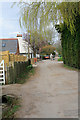
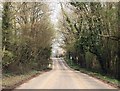
Clay Street, Whiteparish
This is mainly an un-madeup road with housing on each side.
Image: © Peter Facey
Taken: 16 Mar 2007
0.14 miles
5

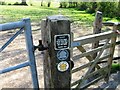
A few signs
Actually, rather more signs than were surely necessary?
Image: © David Martin
Taken: 25 Jan 2020
0.17 miles
6
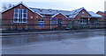
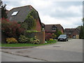
Whiteparish Primary School
The school was established in 1842, and has been considerably expanded in recent years and can accommodate up to 110 children.
Image: © Maigheach-gheal
Taken: 27 Jan 2012
0.17 miles
7
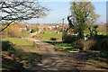
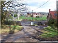
Entrance to Common Farm/Whiteparish Grange
The name varies depending upon whether you look at 1:25,000 or 1:50,000 scale OS maps. Seen from Common Road.
Image: © Peter Facey
Taken: 16 Mar 2007
0.18 miles
8
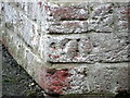
Bench Mark, White Parish Primary School
The Ordnance Survey bench mark is to be found on the north west face of the school. For a view of the building Image and for further information on the cut mark and others in the area http://www.bench-marks.org.uk/bm41112
Image: © Maigheach-gheal
Taken: 27 Jan 2012
0.18 miles