IMAGES TAKEN NEAR TO
Lake, SALISBURY, SP4 7BU
Introduction
This page details the photographs taken nearby to SP4 7BU by members of the Geograph project.
The Geograph project started in 2005 with the aim of publishing, organising and preserving representative images for every square kilometre of Great Britain, Ireland and the Isle of Man.

There are currently over 7.5m images from over14,400 individuals and you can help contribute to the project by visiting https://www.geograph.org.uk
Image Map
Images are licensed for reuse under creativecommons.org/licenses/by-sa/2.0
Notes
- Clicking on the map will re-center to the selected point.
- The higher the marker number, the further away the image location is from the centre of the postcode.
Image Listing (20 Images Found)
Images are licensed for reuse under creativecommons.org/licenses/by-sa/2.0
Image
Details
Distance
1
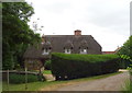
Lake Hill Cottages
Thatched cottages on National Cycle Route 45.
Image: © JThomas
Taken: 13 Jul 2019
0.01 miles
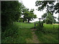
2
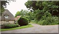
Bridleway, Lake Hill Cottages
Bridleway WCLA 6 leaves the road from Lake to Upper Woodford.
Image: © Derek Harper
Taken: 17 Jul 2016
0.02 miles
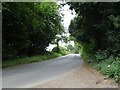
3
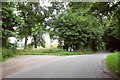
Road past Lake Hill Cottages
The road from Upper Woodford passes two footpaths on the left and a bridleway on the right here and then begins a descent to Lake in the Avon Valley. It's early morning and the light isn't great.
Image: © Derek Harper
Taken: 17 Jul 2016
0.03 miles
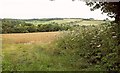
5
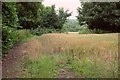
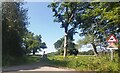
Wheat by Lake Hill Cottages
From the road from Upper Woodford. Bridleway WCLA 6 runs along the belt of trees through which there is an opening revealing the Avon valley.
Image: © Derek Harper
Taken: 17 Jul 2016
0.03 miles
6
Field entrance and footpath off National Cycle Route 45
Image: © JThomas
Taken: 13 Jul 2019
0.03 miles
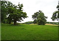
8
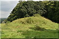
Tumulus with distant view of Lake House
Image: © David Martin
Taken: 29 Aug 2021
0.05 miles
9
Grazing and trees near Great Durnford
Off National Cycle Route 45.
Image: © JThomas
Taken: 13 Jul 2019
0.05 miles
10
Towards the Avon valley
A slightly clearer view through the gap in the trees visible in Image, this time from the bridleway in question. The wood on this side of the valley is The Sling.
Image: © Derek Harper
Taken: 17 Jul 2016
0.06 miles