1
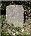
Old Toll House by the A345, Amesbury Road, Salisbury
Old Sarum and side by the A345, in parish of Laverstock (Salisbury District), Beehive Cottage, Amesbury Road, junction with Portway (double gate - Amesbury line and Winterbourn line), SP4.
Grade II listed.
List Entry Number: 1023822 https://historicengland.org.uk/listing/the-list/list-entry/1023822
Surveyed
Milestone Society National ID: WI.LAV
Image: © Alan Rosevear
Taken: Unknown
0.00 miles
2
The Beehive, Salisbury
This is the former toll house on the A345 at the junction of the Salisbury-Amesbury road with the old road to Marlborough. The turnpike closed in 1876 and the house was sold to the Salisbury Dean and Chapter for £100. It was described then as 'a messuage or tenement lately used as a toll house and called the Old Sarum Toll House with the garden and appurtenances'. Locally it has always been referred to as 'The Beehive' and it has recently been restored. It has also given its nickname to the modern Park and Ride facility nearby.
Image: © Maigheach-gheal
Taken: 9 Aug 2009
0.01 miles
3
Ford, piggery
Between Castle Hill and Portway.
Image: © Mike Faherty
Taken: 11 Sep 2011
0.01 miles
4
A345 heading out of Salisbury
There is a 'Park and Ride' just off the roundabout ahead.
Image: © Robin Webster
Taken: 16 Dec 2017
0.01 miles
5
Joining the A345 near the Park and Ride
Image: © Ian S
Taken: 27 May 2013
0.02 miles
6
Ford, footpath
Avoiding the junction of Castle Hill and Portway; looking at the road engineering, it appears that this is the original road junction, now by-passed by a roundabout, left background.
Image: © Mike Faherty
Taken: 11 Sep 2011
0.02 miles
7
Portway nears Beehive Roundabout
Image: © Colin Pyle
Taken: 25 Oct 2014
0.07 miles
8
Beehive park and ride [2]
The entrance from the roundabout.
Around the city of Salisbury are five park and ride locations. Beehive is on the A345 road near Old Sarum.
A cathedral was established at the Iron Age hillfort of Old Sarum by the Normans. In 1220 the cathedral was removed to the nearby plain and New Sarum (Salisbury) grew up around it, receiving a city charter in 1227. Located at the confluence of five rivers (Avon, Nadder, Ebble, Wylye and Bourne) the city is prone to flooding. Traffic between the ports of Southampton and Bristol, passes around the city's ring-road via the A36 causing much congestion.
Image: © Michael Dibb
Taken: 31 Dec 2019
0.09 miles
9
Old Milestone by the A345, Amesbury Road, Laverstock Parish
Carved stone post by the A345, in parish of LAVERSTOCK (SALISBURY District), Amesbury Road; 100m South of the Stratford turn, on narrow verge, on West side of road. Salisbury Roman stone, erected by the Marlborough & Salisbury turnpike trust in the 19th century.
Inscription reads:- : (XXV Miles / To / Marlborough) / II Miles / To / (Sarum) :
Milestone Society National ID: WI_MLSA25.
Image: © M Faherty
Taken: 11 Aug 2007
0.10 miles
10
Towards Old Sarum
Looking towards Old Sarum from by the lane from the A345.
Image: © Ian Capper
Taken: 22 Sep 2022
0.11 miles


![Beehive park and ride [2]](https://s1.geograph.org.uk/geophotos/06/39/06/6390665_f5e404fd_120x120.jpg)

