
IMAGES TAKEN NEAR TO
Roberts Road, SALISBURY, SP2 9BY
Introduction
This page details the photographs taken nearby to Roberts Road, SP2 9BY by members of the Geograph project.
The Geograph project started in 2005 with the aim of publishing, organising and preserving representative images for every square kilometre of Great Britain, Ireland and the Isle of Man.

There are currently over 7.5m images from over14,400 individuals and you can help contribute to the project by visiting https://www.geograph.org.uk
Image Map
Images are licensed for reuse under creativecommons.org/licenses/by-sa/2.0
Notes
- Clicking on the map will re-center to the selected point.
- The higher the marker number, the further away the image location is from the centre of the postcode.
Image Listing (44 Images Found)
Images are licensed for reuse under creativecommons.org/licenses/by-sa/2.0
Image
Details
Distance
1
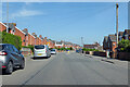
A360 Devizes Road, Salisbury
Heading out of town.
Image: © Robin Webster
Taken: 30 May 2021
0.05 miles
2

Roberts Road
Road between Roman Road and Queen Alexandra Road, running parallel to Devizes Road. The road was first marked on the 1926 25 inch map, including the house on the right. The land beyond the house is shown as a nursery on that map but then as developed on the 1939 edition.
Image: © Ian Capper
Taken: 22 Sep 2022
0.10 miles
3
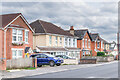
Devizes Road
Housing on Devizes Road, with development here first marked on the 1938 25 inch map.
Image: © Ian Capper
Taken: 22 Sep 2022
0.10 miles
4
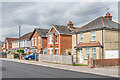
Devizes Road
Housing on Devizes Road, with development here first marked on the 1938 25 inch map.
Image: © Ian Capper
Taken: 22 Sep 2022
0.11 miles
5
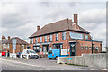
The Royal Oak
Pub on Devizes Road built in 1939. The 1938 25 inch map shows much of this part of Devizes Road developed, but not a short section here.
Image: © Ian Capper
Taken: 22 Sep 2022
0.12 miles
6

Houses at the junction of Roberts Road with Roman Road, Salisbury
Image: © Richard Law
Taken: 2 Apr 2025
0.13 miles
7
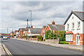
Devizes Road
Housing on Devizes Road, with development here first marked on the 1938 25 inch map.
Image: © Ian Capper
Taken: 22 Sep 2022
0.13 miles
8
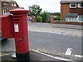
George V Postbox, Salisbury
The postbox is almost opposite the Royal Oak.
Image: © Maigheach-gheal
Taken: 3 Aug 2008
0.13 miles
9
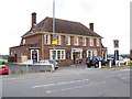
Royal Oak, Salisbury
The Royal Oak is on the A360, Devizes Road.
Image: © Maigheach-gheal
Taken: 3 Aug 2008
0.14 miles
10

Ladysmith Road
Image: © Jonathan Kington
Taken: 9 Jan 2012
0.14 miles