1
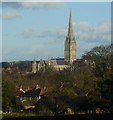
View From Harnham Hill, Salisbury
Looking across the valley in the direction of Salisbury Cathedral. With its spire reaching to 404 feet, the cathedral dwarfs the surrounding buildings.
Image: © Peter Trimming
Taken: 17 Nov 2009
0.04 miles
2
View From Harnham Hill, Salisbury
Looking down across the houses, in the direction of Salisbury Cathedral. The rivers Avon and Nadder flow through the bottom of the valley, on this side of the cathedral, demonstrating that the cathedral is built on higher ground.
Image: © Peter Trimming
Taken: 17 Nov 2009
0.05 miles
3
Trees on a traffic island in Harnham
A short island, which has the effect of slowing traffic through Harnham
Image: © David Smith
Taken: 26 Jun 2013
0.07 miles
4
Salisbury houses [12]
This hideous modern housing development should never have been allowed to be built - especially fronting an important road. The development is so out of keeping with the other properties in the area. It is not helped by the different window styles and different paint schemes.
A cathedral was established at the Iron Age hillfort of Old Sarum by the Normans. In 1220 the cathedral was removed to the nearby plain and New Sarum (Salisbury) grew up around it, receiving a city charter in 1227. Located at the confluence of five rivers (Avon, Nadder, Ebble, Wylye and Bourne) the city is prone to flooding. Traffic between the ports of Southampton and Bristol, passes around the city's ring-road via the A36 causing much congestion.
Image: © Michael Dibb
Taken: 31 Dec 2019
0.08 miles
5
Salisbury houses [11]
The Old Parsonage was originally a farmhouse. The six eastern bays (nearest the camera) are circa 1600, the two western bays are 16th century. A small addition to the north is 18th century. The southern front to the road is masked by tile-hanging and all openings are modern. One of the rooms has an ornate plaster ceiling of circa 1600. There is more details and a plan of the house (monument number 581) at https://www.british-history.ac.uk/rchme/salisbury/pp167-174 Listed, grade II, with details at: https://historicengland.org.uk/listing/the-list/list-entry/1260123
A cathedral was established at the Iron Age hillfort of Old Sarum by the Normans. In 1220 the cathedral was removed to the nearby plain and New Sarum (Salisbury) grew up around it, receiving a city charter in 1227. Located at the confluence of five rivers (Avon, Nadder, Ebble, Wylye and Bourne) the city is prone to flooding. Traffic between the ports of Southampton and Bristol, passes around the city's ring-road via the A36 causing much congestion.
Image: © Michael Dibb
Taken: 31 Dec 2019
0.08 miles
6
Harnham, junior school
Harnham CofE Junior School, on Saxon Road: http://www.harnham-jun.wilts.sch.uk/about-us-our-school.htm
Image: © Mike Faherty
Taken: 14 Apr 2013
0.08 miles
7
Lower Street, Salisbury
This road runs down towards the river, but the gradient is nowhere near as steep as the road sign might suggest.
Image: © Peter Trimming
Taken: 17 Nov 2009
0.08 miles
8
Recreation equipment, Harnham
A basketball hoop and chill-out seat in the park
Image: © David Smith
Taken: 18 Oct 2016
0.08 miles
9
Salisbury features [8]
From Harnham Road this path leads across the recreation ground to Town Path, near the Old Mill.
A cathedral was established at the Iron Age hillfort of Old Sarum by the Normans. In 1220 the cathedral was removed to the nearby plain and New Sarum (Salisbury) grew up around it, receiving a city charter in 1227. Located at the confluence of five rivers (Avon, Nadder, Ebble, Wylye and Bourne) the city is prone to flooding. Traffic between the ports of Southampton and Bristol, passes around the city's ring-road via the A36 causing much congestion.
Image: © Michael Dibb
Taken: 31 Dec 2019
0.09 miles
10
Former school, Harnham
From about 1850, grade II listed. Believed to be offices now.
Image: © Robin Webster
Taken: 16 Dec 2017
0.09 miles


![Salisbury houses [12]](https://s3.geograph.org.uk/geophotos/06/39/19/6391999_22967625_120x120.jpg)
![Salisbury houses [11]](https://s0.geograph.org.uk/geophotos/06/39/19/6391996_a3b0ff17_120x120.jpg)


![Salisbury features [8]](https://s0.geograph.org.uk/geophotos/06/39/20/6392000_66fc974d_120x120.jpg)
