Salisbury houses [11]
Introduction
The photograph on this page of Salisbury houses [11] by Michael Dibb as part of the Geograph project.
The Geograph project started in 2005 with the aim of publishing, organising and preserving representative images for every square kilometre of Great Britain, Ireland and the Isle of Man.

There are currently over 7.5m images from over 14,400 individuals and you can help contribute to the project by visiting https://www.geograph.org.uk
Salisbury houses [11]
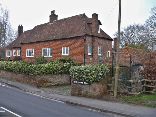
Image: © Michael Dibb Taken: 31 Dec 2019
The Old Parsonage was originally a farmhouse. The six eastern bays (nearest the camera) are circa 1600, the two western bays are 16th century. A small addition to the north is 18th century. The southern front to the road is masked by tile-hanging and all openings are modern. One of the rooms has an ornate plaster ceiling of circa 1600. There is more details and a plan of the house (monument number 581) at https://www.british-history.ac.uk/rchme/salisbury/pp167-174 Listed, grade II, with details at: https://historicengland.org.uk/listing/the-list/list-entry/1260123 A cathedral was established at the Iron Age hillfort of Old Sarum by the Normans. In 1220 the cathedral was removed to the nearby plain and New Sarum (Salisbury) grew up around it, receiving a city charter in 1227. Located at the confluence of five rivers (Avon, Nadder, Ebble, Wylye and Bourne) the city is prone to flooding. Traffic between the ports of Southampton and Bristol, passes around the city's ring-road via the A36 causing much congestion.
Images are licensed for reuse under creativecommons.org/licenses/by-sa/2.0
Image Location
Latitude
51.06117
Longitude
-1.807596