IMAGES TAKEN NEAR TO
Mill Stream Approach, SALISBURY, SP1 3UE

Introduction

This page details the photographs taken nearby to Mill Stream Approach, SP1 3UE by members of the Geograph project.

The Geograph project started in 2005 with the aim of publishing, organising and preserving representative images for every square kilometre of Great Britain, Ireland and the Isle of Man.

There are currently over 7.5m images from over14,400 individuals and you can help contribute to the project by visiting https://www.geograph.org.uk

Image Map


Images are licensed for reuse under creativecommons.org/licenses/by-sa/2.0
Notes
  • Clicking on the map will re-center to the selected point.
  • The higher the marker number, the further away the image location is from the centre of the postcode.

Image Listing (462 Images Found)

Images are licensed for reuse under creativecommons.org/licenses/by-sa/2.0
  • ...
Image
Details
Distance
1
Hussey's Almshouses
With the flowers continuing to brighten up the homes in this warm autumn.
Image: © Neil Owen Taken: 23 Sep 2013
0.02 miles
2
Rebuilt 1875
Hussey's Almshouses were a generous gift to Salisbury in 1794, and rebuilt in 1875. The houses were officially Grade II listed in 1972.
Image: © Neil Owen Taken: 23 Sep 2013
0.03 miles
3
Black Horse House and 136 - 140 Castle Street
Buildings in Castle Street. Nos. 136 - 140, the block on the left, dates from the early - mid 19th Century. Grade II listed - see https://historicengland.org.uk/listing/the-list/list-entry/1249137?section=official-list-entry. Black Horse House, on the right, is a residential conversion of a former pub, the Black Horse, dating from c.1850 but which closed in February 2009 (according to the planning application for conversion) - see Image for a photo when a pub.
Image: © Ian Capper Taken: 22 Sep 2022
0.03 miles
4
Salisbury - Offices
These offices stand alongside the River Avon.
Image: © Chris Talbot Taken: 1 Jan 2010
0.03 miles
5
Salisbury - Black Horse Public House
The Black Horse in Castle Street.
Image: © Chris Talbot Taken: 1 Jan 2010
0.03 miles
6
Hussey's Almshouses
Now run by a local charity the fourteen Grade II listed almshouses were originally founded by William Hussey, a local Member of Parliament in 1794. They were given a full rebuild in 1875.
Image: © Jonathan Kington Taken: 23 May 2011
0.03 miles
7
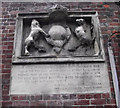
Relic stonework
This ancient stone plaque is located on the end wall off Image, it was placed here in 1908 to mark the location of the former Castle Street gate that was used for defence in the 18th century.
Image: © Jonathan Kington Taken: 23 May 2011
0.03 miles
8
Hussey's Almshouses
These almshouses are on Castle St and are run by a local charity. They were founded in 1794 and rebuilt in 1875. There are 14 of them gathered round this courtyard.
Image: © Nigel Mykura Taken: 30 Oct 2010
0.03 miles
9
Sign at "The Boathouse" PH
Image: © Shazz Taken: 23 Apr 2013
0.03 miles
10
Castle Street
Buildings in Castle Street, with no 150 nearest.
Image: © Ian Capper Taken: 22 Sep 2022
0.03 miles
  • ...