Black Horse House and 136 - 140 Castle Street
Introduction
The photograph on this page of Black Horse House and 136 - 140 Castle Street by Ian Capper as part of the Geograph project.
The Geograph project started in 2005 with the aim of publishing, organising and preserving representative images for every square kilometre of Great Britain, Ireland and the Isle of Man.

There are currently over 7.5m images from over 14,400 individuals and you can help contribute to the project by visiting https://www.geograph.org.uk
Black Horse House and 136 - 140 Castle Street
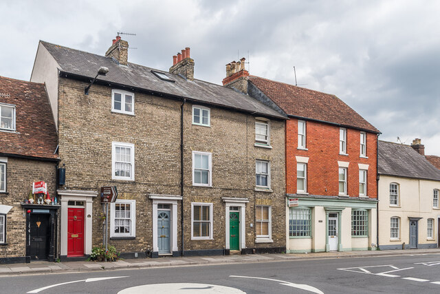
Image: © Ian Capper Taken: 22 Sep 2022
Buildings in Castle Street. Nos. 136 - 140, the block on the left, dates from the early - mid 19th Century. Grade II listed - see https://historicengland.org.uk/listing/the-list/list-entry/1249137?section=official-list-entry. Black Horse House, on the right, is a residential conversion of a former pub, the Black Horse, dating from c.1850 but which closed in February 2009 (according to the planning application for conversion) - see Image for a photo when a pub.
Images are licensed for reuse under creativecommons.org/licenses/by-sa/2.0
Image Location


Leaflet Map data © OpenStreetMap
Latitude
51.072921
Longitude
-1.796086