1
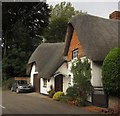
St Mary Bourne: Bells Meadow
Image: © Michael Garlick
Taken: 17 Dec 2022
0.02 miles
2
B3048 leaving St Mary Bourne
Past the junction with the lane to Five Lanes. The cottages past the trees are in
Image, on the way to Swampton.
Image: © Derek Harper
Taken: 15 Oct 2012
0.05 miles
3
Cottage, St Mary Bourne
This eye-catchingthatched cottage on the B3048 at the west end of the village has C16 origins https://historicengland.org.uk/listing/the-list/list-entry/1093045 .
Image: © Derek Harper
Taken: 15 Oct 2012
0.05 miles
4
Mundays, St Mary Bourne, Hampshire
C17, late C18. House at right-angles to the road; one storey and attic, to ground floor windows. Thatched roof, 2 eyebrow dormers. Walling of flint with brick dressings, and also of brickwork, both now painted; some cambered openings. Casements, one sash. Plain doorways. Heavy beams within, and a massive open hearth with a timber bressumer inscribed RHA 1676. Modern extensions on the west end, containing a garage.
(Source:Historic England)
Image: © Oswald Bertram
Taken: 2 Oct 2015
0.05 miles
5
Springhill Lodge, St Mary Bourne, Hampshire
Mid C19. Two-storeyed house with a gabled central projection on the south elevation, and a half-hexagon east side (facing the driveway). Slate roof, scalloped bargeboard. Painted brickwork in Flemish Garden Wall bond, cambered openings. Cast-iron frames to the casements, with an oriel above the doorway in the centre of the east elevation. Slate-roofed verandah round the east side, supported on posts.
(Source:Historic England)
Image: © Oswald Bertram
Taken: 2 Oct 2015
0.05 miles
6
Swampton - Wayfarers Cottage
This is a two storey limewashed brick cottage with a thatched roof. The central gabled porch is Victorian.
Image: © Chris Talbot
Taken: 16 Apr 2008
0.06 miles
7
St Mary Bourne - Cottages
Typical cottages in the centre of the village.
Image: © Chris Talbot
Taken: 16 Apr 2008
0.08 miles
8
St Mary Bourne - Old Stables
These stables are found in the centre of the village.
Image: © Chris Talbot
Taken: 16 Apr 2008
0.08 miles
9
Cottages on the B3048, St Mary Bourne
First on the right are Holdway Cottages, almshouses built in 1862 https://historicengland.org.uk/listing/the-list/list-entry/1308082 ; the yellowish plaque in the centre is a memorial to Robert Holdway. Beyond are the cottages shown in
Image, and from the other direction in
Image The thatched Knapp Cottage is C18 in origin, and is described at https://historicengland.org.uk/listing/the-list/list-entry/1339796 ; the former post office is described at https://historicengland.org.uk/listing/the-list/list-entry/1175979 . Almost hiddent between the post office and the almshouses is a cottage listed as "Post Office Outbuilding", now Willow Cottage https://historicengland.org.uk/listing/the-list/list-entry/1092405 .
Image: © Derek Harper
Taken: 15 Oct 2012
0.08 miles
10
Arched bridge over the Bourne Rivulet
Image: © David Martin
Taken: 5 Aug 2018
0.08 miles


