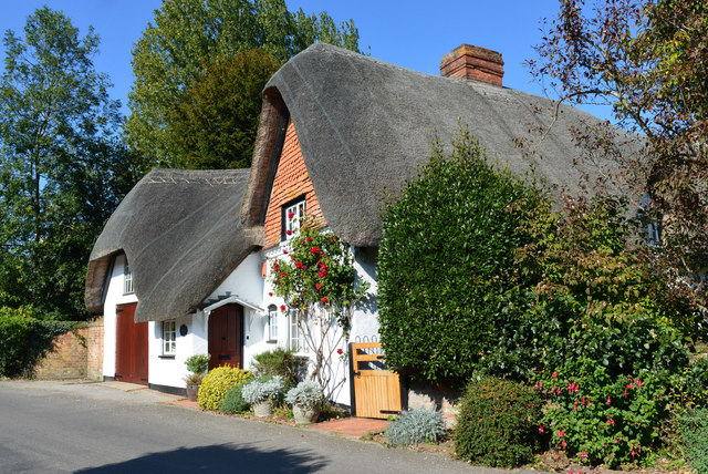
Mundays, St Mary Bourne, Hampshire
Introduction
The photograph on this page of Mundays, St Mary Bourne, Hampshire by Oswald Bertram as part of the Geograph project.
The Geograph project started in 2005 with the aim of publishing, organising and preserving representative images for every square kilometre of Great Britain, Ireland and the Isle of Man.
There are currently over 7.5m images from over 14,400 individuals and you can help contribute to the project by visiting https://www.geograph.org.uk

Image: © Oswald Bertram Taken: 2 Oct 2015
C17, late C18. House at right-angles to the road; one storey and attic, to ground floor windows. Thatched roof, 2 eyebrow dormers. Walling of flint with brick dressings, and also of brickwork, both now painted; some cambered openings. Casements, one sash. Plain doorways. Heavy beams within, and a massive open hearth with a timber bressumer inscribed RHA 1676. Modern extensions on the west end, containing a garage. (Source:Historic England)

