1
It's a cat's life
Out of harm's way, this cat soaks up the sun on the roof of the Ponderosa porch.
Image: © Graham Horn
Taken: 12 Jul 2008
0.01 miles
2
St Mary Bourne - War Memorial
In Flanders field the poppies grow...
Image: © Chris Talbot
Taken: 8 May 2004
0.03 miles
3
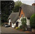
Thatched cottage at St Mary Bourne
Image: © David Martin
Taken: 5 Aug 2018
0.04 miles
4
B3048 passes Old Post Office
The red brick and flint building is the 'Post Office'. a Grade II listed building with English Heritage Building ID: 138433. Timber framing dates from 17th C but external surfaces are 200 years younger. In the picture Devoran and Rivers Edge are receiving a visit from the postman. They are also Grade II listed and their neighbouring building brackets their i.e. 18th C. They have English Heritage Building ID: 138432. For details of all listed buildings in the village see: http://www.britishlistedbuildings.co.uk/england/hampshire/st+mary+bourne
Image: © Stuart Logan
Taken: 31 Aug 2012
0.05 miles
5
Village houses, St Mary Bourne, Hampshire
Image: © Oswald Bertram
Taken: 2 Oct 2015
0.05 miles
6
Village house, St Mary Bourne, Hampshire
Image: © Oswald Bertram
Taken: 2 Oct 2015
0.06 miles
7
St Mary Bourne - The George Public House
The George Public House
Image: © Chris Talbot
Taken: 2 Nov 2007
0.07 miles
8
Bourne Rivulet
The Bourne Rivulet flows south (towards us) through St Mary Bourne towards its confluence with the River Test about four miles further south.
Image: © Graham Horn
Taken: 12 Jul 2008
0.08 miles
9
Cottage, St Mary Bourne
This eye-catchingthatched cottage on the B3048 at the west end of the village has C16 origins https://historicengland.org.uk/listing/the-list/list-entry/1093045 .
Image: © Derek Harper
Taken: 15 Oct 2012
0.08 miles
10
Mundays, St Mary Bourne, Hampshire
C17, late C18. House at right-angles to the road; one storey and attic, to ground floor windows. Thatched roof, 2 eyebrow dormers. Walling of flint with brick dressings, and also of brickwork, both now painted; some cambered openings. Casements, one sash. Plain doorways. Heavy beams within, and a massive open hearth with a timber bressumer inscribed RHA 1676. Modern extensions on the west end, containing a garage.
(Source:Historic England)
Image: © Oswald Bertram
Taken: 2 Oct 2015
0.08 miles


