IMAGES TAKEN NEAR TO
Dunwood Hill, ROMSEY, SO51 6FD
Introduction
This page details the photographs taken nearby to Dunwood Hill, SO51 6FD by members of the Geograph project.
The Geograph project started in 2005 with the aim of publishing, organising and preserving representative images for every square kilometre of Great Britain, Ireland and the Isle of Man.

There are currently over 7.5m images from over14,400 individuals and you can help contribute to the project by visiting https://www.geograph.org.uk
Image Map
Images are licensed for reuse under creativecommons.org/licenses/by-sa/2.0
Notes
- Clicking on the map will re-center to the selected point.
- The higher the marker number, the further away the image location is from the centre of the postcode.
Image Listing (8 Images Found)
Images are licensed for reuse under creativecommons.org/licenses/by-sa/2.0
Image
Details
Distance
1
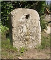
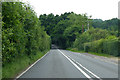
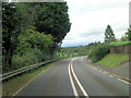
Old Milestone by the A27, Salisbury Road
Stone post (plate lost) by the A27, in parish of WELLOW (TEST VALLEY District), Dunwood Hill, by "Mile End", on embankment, on East side of road. Romsey tombstone marker, erected by the Whiteparish, Romsey & Southampton turnpike trust in the 19th century.
Inscription once read:-
(SALISBURY)
(12)
(ROMSEY)
(3)
(SOUTHAMPTON)
(10)
Grade II listed.
List Entry Number: 1301105 https://historicengland.org.uk/listing/the-list/list-entry/1301105
Milestone Society National ID: HA_ROSA03
Image: © K Lawrence
Taken: 24 Oct 2002
0.03 miles
3
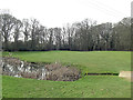
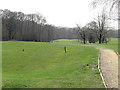
Dunwood Manor Golf Course 13th green
This is a 302 yard par 4 hole which finishes at this green: the most southerly part of the course. The hole is stroke index 13 and needs a judicious 'lay-up' from the tee to avoid the ball ending up in this pond and its associated ditch.
Image: © Stuart Logan
Taken: 22 Mar 2012
0.12 miles
6
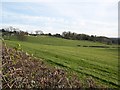
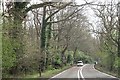
Across fields southeast of A27
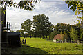
Evening view across farmland to the southeast of the A27 towards a small, scattered settlement known as The Frenches.
Image: © David Martin
Taken: 17 Apr 2008
0.20 miles
7
Dunwood Manor Golf Course 12th hole
Making use of the natural terrain is one of the main tasks of a golf course designer. Here a par 3 210 yards hole is rendered the 5th most difficult on the course by a 100 foot drop between tee and green.
Image: © Stuart Logan
Taken: 22 Mar 2012
0.21 miles