
IMAGES TAKEN NEAR TO
Powell Crescent, SOUTHAMPTON, SO40 9FF
Introduction
This page details the photographs taken nearby to Powell Crescent, SO40 9FF by members of the Geograph project.
The Geograph project started in 2005 with the aim of publishing, organising and preserving representative images for every square kilometre of Great Britain, Ireland and the Isle of Man.

There are currently over 7.5m images from over14,400 individuals and you can help contribute to the project by visiting https://www.geograph.org.uk
Image Map
Images are licensed for reuse under creativecommons.org/licenses/by-sa/2.0
Notes
- Clicking on the map will re-center to the selected point.
- The higher the marker number, the further away the image location is from the centre of the postcode.
Image Listing (16 Images Found)
Images are licensed for reuse under creativecommons.org/licenses/by-sa/2.0
Image
Details
Distance
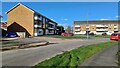
2
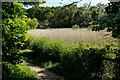
Reeds beside the path
Bartley Water runs beyond.
Image: © John Lucas
Taken: 24 May 2023
0.14 miles
3
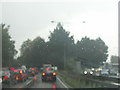
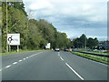
Traffic on Spicer's Hill, Totton, Hants
One busy wet Sunday morning!
Image: © Graham Nelson
Taken: 30 Oct 2005
0.15 miles
4
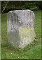
Old Milestone by the A35, Spicers Hill, Rushington
Carved stone post by the A35, in parish of TOTTON AND ELING (NEW FOREST District), Rushington, junction of Spicers Hill and The Drive, on deep verge, on East side of road. Erected by the Lymington, Lyndhurst & Rumbridge turnpike trust in the 19th century.
Inscription reads:-
: LYMINGTON / 13 : : SOUTHAMPTON / 5 :
Milestone Society National ID: HA_SOLH05.
Image: © K Lawrence
Taken: 7 Dec 2003
0.16 miles
5
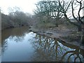
Bartley Water
Taken at dusk looking downstream from a footbridge crossed by Totton and Eling Footpath 32 and the Test Way. This is marked on maps as the normal tidal limit of the river.
Image: © Derek Harper
Taken: 17 Feb 2010
0.16 miles
7
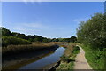
Bartley Water on the southern part of the Test Way
The first mile of the Way follows Bartley Water.
Image: © Tim Heaton
Taken: 9 Oct 2023
0.21 miles
8
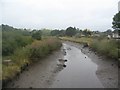
Tidal creek at Eling
Bartley Water, upstream of the footbridge, at almost low tide.
Image: © E Gammie
Taken: 9 Sep 2019
0.22 miles
9
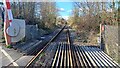
Northwest view from level crossing in Jacob's Gutter Lane
Looking to the left from the barrier seen in Image
Image: © David Martin
Taken: 26 Feb 2024
0.22 miles
10
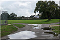
Totton recreation ground
The site of the Annual Totton Fair, which has been operating since the end of the 2nd World War, apart from during the covid hiatus.
Image: © John Lucas
Taken: 8 Sep 2022
0.23 miles