IMAGES TAKEN NEAR TO
Petersfield Road, WINCHESTER, SO23 8RU
Introduction
This page details the photographs taken nearby to Petersfield Road, SO23 8RU by members of the Geograph project.
The Geograph project started in 2005 with the aim of publishing, organising and preserving representative images for every square kilometre of Great Britain, Ireland and the Isle of Man.

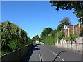
There are currently over 7.5m images from over14,400 individuals and you can help contribute to the project by visiting https://www.geograph.org.uk
Image Map
Images are licensed for reuse under creativecommons.org/licenses/by-sa/2.0
Notes
- Clicking on the map will re-center to the selected point.
- The higher the marker number, the further away the image location is from the centre of the postcode.
Image Listing (53 Images Found)
Images are licensed for reuse under creativecommons.org/licenses/by-sa/2.0
Image
Details
Distance
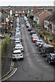
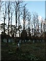
2
View over Highcliffe
A southeastern suburb of Winchester, with downland beyond.
Image: © David Martin
Taken: 9 Jan 2022
0.10 miles
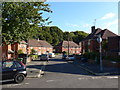
3
Northbrook Avenue
A residential road at the top of St Giles Hill. The top of the hill here appears perfectly flat.
Image: © Bill Boaden
Taken: 2 Sep 2021
0.12 miles
4
Northbrook Avenue
A residential road on the top of St Giles Hill. The slope down towards Winchester starts at the end of the road which can just be seen.
Image: © Bill Boaden
Taken: 2 Sep 2021
0.13 miles
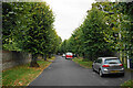
5
South Downs Way, Winchester to Exton (12)
Mid section of Petersfield Road
Image: © Basher Eyre
Taken: 23 Aug 2014
0.14 miles
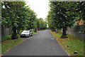
6
South Downs Way, Winchester to Exton (13)
Gordon Avenue, last real glimpse of an urban scene for quite some time!
Image: © Basher Eyre
Taken: 23 Aug 2014
0.15 miles
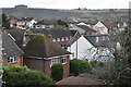
7
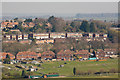
Highcliffe area of Winchester
In the foreground is a small part of King George V playing field. Beyond that are houses in Gordon Avenue. Beyond them the row of whitish houses are in Chalk Ridge. Taken from Twyford Down.
Image: © Peter Facey
Taken: 1 Apr 2009
0.16 miles
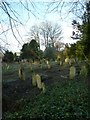
10
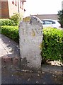
Old Boundary Marker by Quarry Road, Winchester
Boundary Marker by the UC road, in parish of Winchester (Winchester District), Quarry Road, by Chilcomb Heights at back of pavement.
Weathered inscription reads:-
B.W.
18(??)
Surveyed
Milestone Society National ID: HA_WINBW01bm
Image: © Milestone Society
Taken: Unknown
0.17 miles